
IMAGES TAKEN NEAR TO
Elm Road, WALSALL, WS3 1BH
Introduction
This page details the photographs taken nearby to Elm Road, WS3 1BH by members of the Geograph project.
The Geograph project started in 2005 with the aim of publishing, organising and preserving representative images for every square kilometre of Great Britain, Ireland and the Isle of Man.

There are currently over 7.5m images from over14,400 individuals and you can help contribute to the project by visiting https://www.geograph.org.uk
Image Map
Images are licensed for reuse under creativecommons.org/licenses/by-sa/2.0
Notes
- Clicking on the map will re-center to the selected point.
- The higher the marker number, the further away the image location is from the centre of the postcode.
Image Listing (20 Images Found)
Images are licensed for reuse under creativecommons.org/licenses/by-sa/2.0
Image
Details
Distance
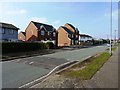
2
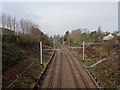
Birchills railway station (site), West Midlands
Opened in 1858 by the South Staffordshire Railway on what is today the line from Walsall to Rugeley, this station closed at the start of 1916.
View north west towards Bloxwich and Rugeley shortly after the line was electrified. No trace remains.
Image: © Nigel Thompson
Taken: 25 Jan 2019
0.13 miles
3
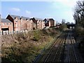
New houses backing onto the railway line
The line forms part of the Bloxwich to Walsall route; it's clear from walking around the area that quite a lot of regeneration is underway, including a number of extensive new housing developments.
Image: © Richard Law
Taken: 18 Feb 2013
0.14 miles
4
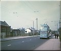
Walsall trolleybus in Bloxwich Road
Sunbeam F4 trolleybus F4 No 351 (ADX 189) on route 33 travelling towards Walsall town centre. It was formerly in service with Ipswich Corporation Transport and has Park Royal 56-seater bodywork dating from 1950.
Image: © David Hillas
Taken: 20 Sep 1969
0.16 miles
7
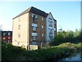
Canalside housing on Eagleworks Drive
A four-storey block of flats on the west bank of the Wyrley & Essington Canal.
Image: © Christine Johnstone
Taken: 6 May 2018
0.19 miles
8
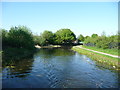
Wyrley & Essington Canal at Birchills Old Stop
Between Pratts Mill Bridge and Forest Bridge.
Image: © Christine Johnstone
Taken: 6 May 2018
0.19 miles
9
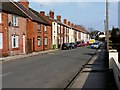
Terraced housing on May Street
A row of terraced houses, leading up to the B4210 Bloxwich Road.
Image: © Richard Law
Taken: 18 Feb 2013
0.20 miles
10
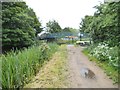
Forest Footbridge View
The view along the Wyrley and Essington Canal in Harden, Walsall.
Image: © Gordon Griffiths
Taken: 29 May 2014
0.20 miles