
IMAGES TAKEN NEAR TO
Primley Avenue, WALSALL, WS2 9UP
Introduction
This page details the photographs taken nearby to Primley Avenue, WS2 9UP by members of the Geograph project.
The Geograph project started in 2005 with the aim of publishing, organising and preserving representative images for every square kilometre of Great Britain, Ireland and the Isle of Man.

There are currently over 7.5m images from over14,400 individuals and you can help contribute to the project by visiting https://www.geograph.org.uk
Image Map
Images are licensed for reuse under creativecommons.org/licenses/by-sa/2.0
Notes
- Clicking on the map will re-center to the selected point.
- The higher the marker number, the further away the image location is from the centre of the postcode.
Image Listing (19 Images Found)
Images are licensed for reuse under creativecommons.org/licenses/by-sa/2.0
Image
Details
Distance
1
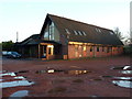
The Church at Junction 10
Very imaginatively named, but very appropriate! That said, the maps do mark another church a couple of hundred yards to the west (on the north/other side of the A454) and a bit closer to the motorway junction, but which is unphotographed as of today. It may no longer exist.
Image: © Richard Law
Taken: 9 Jan 2013
0.10 miles
5
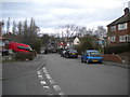
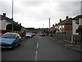
North end of Southbourne Avenue, Alumwell Road estate
Looking towards the footpath linking it to Wolverhampton Road.
Image: © Richard Vince
Taken: 9 Feb 2019
0.15 miles
6
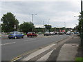
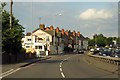
Bloxwich Lane Meets Wolverhampton Road
Image: © Peter Whatley
Taken: 13 Jul 2009
0.16 miles
7
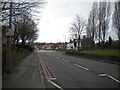
Wolverhampton Road, Reedswood
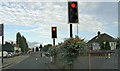
Looking towards the traffic lights at the junction with Primley Avenue and Lane Avenue at a quiet moment. Junction 10 of the M6 is a little further along.
Image: © Richard Vince
Taken: 9 Feb 2019
0.16 miles
8
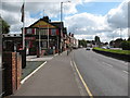
The Parkbrook
A454 Wolverhampton Road, Walsall.
Image: © Adrian Rothery
Taken: 14 Aug 2008
0.16 miles
9
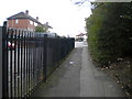
Footpath to Southbourne Avenue, Alumwell Road estate
From Wolverhampton Road.
Image: © Richard Vince
Taken: 9 Feb 2019
0.17 miles
10
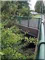
Bridge over the Anson Branch Canal
The Anson Branch, opened in 1830, ran from near the James Bridge Aqueduct on the Walsall Canal north east for about two miles to serve mines in the Bentley area. The line of the canal was severed and culverted under the M6 motorway junction in the late 1960s. The section west of Bentley Mill Lane is still in water. North west of the motorway it is overgrown.
Image: © John M
Taken: 13 Jul 2008
0.19 miles