
IMAGES TAKEN NEAR TO
Aldis Road, WALSALL, WS2 9AY
Introduction
This page details the photographs taken nearby to Aldis Road, WS2 9AY by members of the Geograph project.
The Geograph project started in 2005 with the aim of publishing, organising and preserving representative images for every square kilometre of Great Britain, Ireland and the Isle of Man.

There are currently over 7.5m images from over14,400 individuals and you can help contribute to the project by visiting https://www.geograph.org.uk
Image Map
Images are licensed for reuse under creativecommons.org/licenses/by-sa/2.0
Notes
- Clicking on the map will re-center to the selected point.
- The higher the marker number, the further away the image location is from the centre of the postcode.
Image Listing (13 Images Found)
Images are licensed for reuse under creativecommons.org/licenses/by-sa/2.0
Image
Details
Distance
4
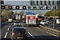
Birmingham : The M6 Motorway
The M6 Motorway heading north through Birmingham.
Image: © Lewis Clarke
Taken: 29 Oct 2013
0.16 miles
5
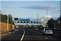
M6 heading south, approaching Junction 9
Image: © N Chadwick
Taken: 24 Jun 2012
0.18 miles
6

Railway junction at Pleck
With the bridge under the M6 visible in the distance.
Image: © Andrew Abbott
Taken: 25 May 2019
0.20 miles
7
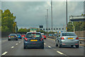
Walsall : M6 Motorway
The M6 Motorway between Junction 9 (Wednesbury) and Junction 10 (Walsall Interchange).
Image: © Lewis Clarke
Taken: 22 Sep 2019
0.21 miles
8
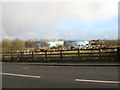
James Bridge gasholders from A4038 - Walsall, West Midlands
A slightly more distant view of the gasholders in 'Sometime to disappear?' from the A4038 Darlaston Road. Demolition of these landmarks is apparently still planned but when is not clear, neither is the future use of the site. In November 1940 during an air raid a bomb dropped on this site but failed to explode. The site superintendent at the time, Richard Hateley, was awarded the George Medal for preventing one of the tanks from exploding on that night (source heritagewebsite).
Time taken 3.16 pm GMT (Greenwich Mean Time).
Image
Image: © Martin Richard Phelan
Taken: 30 Jan 2015
0.24 miles
9
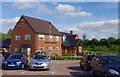
The Chestnut Tree (1), Axletree Way, Wednesbury
This food focussed public house and restaurant opened in 2012. A Marston's house, it is one of about twenty four they opened in that year. With so many pubs closing, it is good to hear that some new ones are opening. This one is very much aimed at shoppers visiting the nearby Ikea store and the Gallagher Retail Park.
Image
Image: © P L Chadwick
Taken: 1 Jun 2013
0.25 miles
10
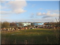
Sometime to disappear? - Walsall, West Midlands
The site of the James Bridge gasholder station south of the Darlaston Road at Pleck, Walsall. The gasholders have been earmarked for demolition, although future use of the site, whether for housing or industry seems not to have yet been finally decided. The gasworks site is a SLINC - Site of Local Interest for Nature Conservation. In November 1940 during an air raid a bomb dropped on this site but failed to explode. The site superintendent at the time, Richard Hateley, was awarded the George Medal for preventing one of the tanks from exploding on that night. Source historywebsite.co.uk. Time taken 3.39 pm GMT (Greenwich Mean Time).
Image: © Martin Richard Phelan
Taken: 30 Jan 2015
0.25 miles