IMAGES TAKEN NEAR TO
Stockton Close, WALSALL, WS2 8LD
Introduction
This page details the photographs taken nearby to Stockton Close, WS2 8LD by members of the Geograph project.
The Geograph project started in 2005 with the aim of publishing, organising and preserving representative images for every square kilometre of Great Britain, Ireland and the Isle of Man.

There are currently over 7.5m images from over14,400 individuals and you can help contribute to the project by visiting https://www.geograph.org.uk
Image Map
Images are licensed for reuse under creativecommons.org/licenses/by-sa/2.0
Notes
- Clicking on the map will re-center to the selected point.
- The higher the marker number, the further away the image location is from the centre of the postcode.
Image Listing (26 Images Found)
Images are licensed for reuse under creativecommons.org/licenses/by-sa/2.0
Image
Details
Distance
1
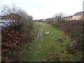
North Walsall railway station (site), West Midlands
Opened in 1872 by the Midland Railway and London & North Western Railway jointly on the line from Wolverhampton to Walsall, this station closed in 1925.
View west towards Bentley and Wolverhampton. The railway line closed completely in 1980 and the cutting in which the station was sited was being filled in when this image was taken.
Image: © Nigel Thompson
Taken: 25 Jan 2019
0.13 miles
2
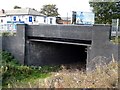
Bloxwich Road over Midland Railway
Walsall to Wolverhampton trackbed.North Walsall station was on far side of bridge
Image: © Ray Durrant
Taken: 4 Oct 2011
0.16 miles
3
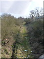
Abandoned railway line
Part of the route of the long-disused Midland Railway; this section ran from Walsall to Wolverhanmpton, via Willenhall (Market Place) and Wednesfield. Much of the route can be traced on the maps and on the ground, but the M6 cuts across it in such a way that there's no chance of it ever being re-opened.
Image: © Richard Law
Taken: 18 Feb 2013
0.19 miles
4
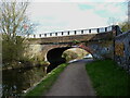
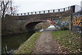
Raybould's Bridge, Wyrley & Essington Canal
Dating from around 1798 when the canal was opened, and Grade II listed https://britishlistedbuildings.co.uk/101342658-wyrley-and-essington-canal-rayboulds-bridge-road-rayboulds-bridge-birchills-leamore-ward#.YOsXFuhKjIU & https://historicengland.org.uk/listing/the-list/list-entry/1342658 in 1986. The graffiti 'artists' have little appreciation for the historical importance of such structures, sadly; to them it's just another brick canvas.
Image: © Richard Law
Taken: 16 Apr 2021
0.19 miles
5
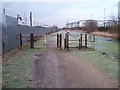
Towpath Barrier - Wyrley & Essington Canal
Situated between Pratts Mill Bridge (Bloxwich Road) and Green Lane Bridge.
Image: © Adrian Rothery
Taken: 6 Feb 2007
0.19 miles
6
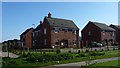
New houses off Shropshire Close
With the Wyrley & Essington Canal towpath in the foreground.
Image: © Christine Johnstone
Taken: 6 May 2018
0.19 miles
7
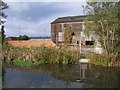
Disused Factory
Alongside the canal and to the west of Bloxwich Road.
Image: © Adrian Rothery
Taken: 20 Oct 2006
0.19 miles