IMAGES TAKEN NEAR TO
Brewer Street, WALSALL, WS2 8BA
Introduction
This page details the photographs taken nearby to Brewer Street, WS2 8BA by members of the Geograph project.
The Geograph project started in 2005 with the aim of publishing, organising and preserving representative images for every square kilometre of Great Britain, Ireland and the Isle of Man.

There are currently over 7.5m images from over14,400 individuals and you can help contribute to the project by visiting https://www.geograph.org.uk
Image Map
Images are licensed for reuse under creativecommons.org/licenses/by-sa/2.0
Notes
- Clicking on the map will re-center to the selected point.
- The higher the marker number, the further away the image location is from the centre of the postcode.
Image Listing (21 Images Found)
Images are licensed for reuse under creativecommons.org/licenses/by-sa/2.0
Image
Details
Distance
1
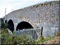
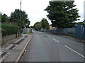
Midland Railway Walsall to Wolverhampton
Bridge over trackbed between Mill Street & Brewer Street
Image: © Ray Durrant
Taken: 4 Oct 2011
0.04 miles
3
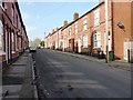
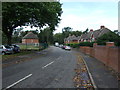
Proffit Street
Heading north east towards Ryecroft.
Image: © JThomas
Taken: 5 Oct 2013
0.07 miles
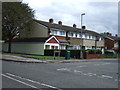
7
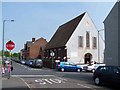
Seventh Day Adventist Church, Mill Street, Walsall
Image: © Geoff Pick
Taken: 28 Apr 2007
0.12 miles