IMAGES TAKEN NEAR TO
Edinburgh Lane, WALSALL, WS2 7RD

Introduction

This page details the photographs taken nearby to Edinburgh Lane, WS2 7RD by members of the Geograph project.

The Geograph project started in 2005 with the aim of publishing, organising and preserving representative images for every square kilometre of Great Britain, Ireland and the Isle of Man.

There are currently over 7.5m images from over14,400 individuals and you can help contribute to the project by visiting https://www.geograph.org.uk

Image Map


Images are licensed for reuse under creativecommons.org/licenses/by-sa/2.0
Notes
  • Clicking on the map will re-center to the selected point.
  • The higher the marker number, the further away the image location is from the centre of the postcode.

Image Listing (30 Images Found)

Images are licensed for reuse under creativecommons.org/licenses/by-sa/2.0
  • ...
Image
Details
Distance
1
Magic Lantern (2), Cavendish Road, Walsall
Located on the corner of Cavendish Road, and Bloxwich Lane. The pub is home to a football team and an over-60's luncheon club. Image Image
Image: © P L Chadwick Taken: 3 Aug 2013
0.08 miles
2
Magic Lantern (1), Cavendish Road, Walsall
An estate pub and the last one on the Beechdale Estate. It probably dates from the 1970's, as up to late 1970 part of the site was the turning circle for the terminus of the electric trolleybus service on route 33 from Walsall's centre. Currently the pub is under threat, as its owners, Red Star Estates Limited, have applied for planning permission to refurbish the pub and turn it into a convenience store and shops. The pub apparently has a busy trade and raises a lot of money for charity. Almost 1000 local people have signed a petition against the pub's closure. Image Image
Image: © P L Chadwick Taken: 3 Aug 2013
0.08 miles
3
The Magic Lantern pub
Image: © JThomas Taken: 5 Oct 2013
0.08 miles
4
Magic Lantern (3) - sign, Cavendish Road, Walsall
See also:- Image and Image
Image: © P L Chadwick Taken: 3 Aug 2013
0.08 miles
5
The Magic Lantern
A modern estate pub on the corner of Bloxwich Lane and Cavendish Road. Note the dovecote on the corner of the building.
Image: © Jonathan Billinger Taken: 1 May 2008
0.09 miles
6
Jubilee House
Walsall Primary Care Trust HQ is located next to the M6 motorway. The site is shared with an ambulance station.
Image: © John M Taken: 28 Jul 2007
0.09 miles
7
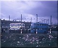
A Motorbus and Trolleybus at Bloxwich Lane/Cavendish Road
Taken on the 3rd October 1970, this photo shows an ex-Birmingham City Transport Guy Arab IV motorbus and 874 (GFU 692) BUT 9611T trolleybus with Northern Coachbuilders 54-seater bodywork, at the Cavendish Road terminus of trolleybus route 33 from Walsall town centre. This extension from Stephenson Avenue was opened on the 2nd September 1963 and was the last such extension on the Walsall trolleybus system. However, it saw only seven years service as the trolleybus system closed on the 3rd October 1970. National Express West Midlands now operates routes 70/70A from this location to Walsall town centre. This turning circle is now occupied by the Magic Lantern public house.
Image: © David Hillas Taken: 3 Oct 1970
0.10 miles
8
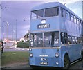
Walsall trolleybus turning at Cavendish Road
BUT trolleybus 874 (GFU 692) on a private tour, turning at Cavendish Road at the junction with Bloxwich Lane. This was the last trolleybus extension in Walsall from Stephenson Avenue which took place on 2nd September, 1963, only to last seven years before the system's closure on 3rd October, 1970.
Image: © David Hillas Taken: 3 Oct 1970
0.10 miles
9
Bloxwich Lane
Heading north. Remains of a disused railway bridge visible.
Image: © JThomas Taken: 5 Oct 2013
0.11 miles
10
Railway bridge abutment
The eastern abutment of the bridge that carried the former Midland Railway from Walsall to Wolverhampton, via Willenhall (Market Place) & Wednesfield, across Bloxwich Lane. Its western equivalent in the trees on the left has been all but dismantled, probably as a result of the M6's construction.
Image: © Richard Law Taken: 2 Nov 2012
0.11 miles
  • ...