
IMAGES TAKEN NEAR TO
Edison Road, WALSALL, WS2 7EZ
Introduction
This page details the photographs taken nearby to Edison Road, WS2 7EZ by members of the Geograph project.
The Geograph project started in 2005 with the aim of publishing, organising and preserving representative images for every square kilometre of Great Britain, Ireland and the Isle of Man.

There are currently over 7.5m images from over14,400 individuals and you can help contribute to the project by visiting https://www.geograph.org.uk
Image Map
Images are licensed for reuse under creativecommons.org/licenses/by-sa/2.0
Notes
- Clicking on the map will re-center to the selected point.
- The higher the marker number, the further away the image location is from the centre of the postcode.
Image Listing (10 Images Found)
Images are licensed for reuse under creativecommons.org/licenses/by-sa/2.0
Image
Details
Distance
1
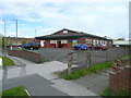
The Rock Church, Edison Road, Walsall
No information to be had on this church - no denomination?
Image: © Jonathan Billinger
Taken: 1 May 2008
0.02 miles
2
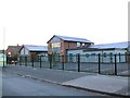
Police Outpost
Small Police outpost in the grey building to the right of the BCHA centre. On Stevenson Avenue at Leamore, Walsall. The main Police Station is a mile or so away, down the A34 towards Walsall centre.
Image: © Roger May
Taken: 18 Dec 2005
0.04 miles
3
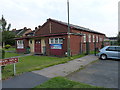
St Chad's Hall
This hall may well have been the original St Chad's church, before the building of the new church a few hundred yards away at Image
Image: © Richard Law
Taken: 5 Sep 2013
0.05 miles
4
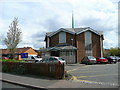
St. Catherine with St. Chad's church, Blakenhall Heath
An octagonal estate church, built in 1957 in Edison Road, Leamore.
Image: © Jonathan Billinger
Taken: 1 May 2008
0.12 miles
5
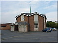
The church of St Catherine with St Chad
One of several churches in the Leamore area; this one is on Edison Road.
Image: © Richard Law
Taken: 5 Sep 2013
0.13 miles
6
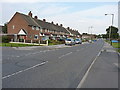
Along Cavendish Road
1950s housing on Cavendish Road in Leamore.
Image: © Richard Law
Taken: 5 Sep 2013
0.18 miles
7
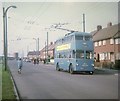
Walsall Trolleybus in Stephenson Avenue
Crossley-Empire trolleybus 850 (HBE 541) on a private tour travelling towards Walsall. The vehicle came from Grimsby-Cleethorpes Transport in 1961 after the trolleybus system was abandoned there.
Image: © David Hillas
Taken: 20 Sep 1969
0.23 miles
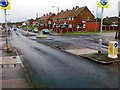
10
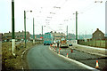
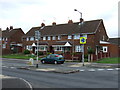
British Trolleybuses - Walsall
At full stretch! Resurfacing on Stephenson Avenue meant that trolleybuses towards town had their poles at full stretch when coming past the works. Drivers had to be particularly careful to ensure that they did not lose contact, but this shows that there was a considerable measure of flexibility available. Most British trolleybus systems did not have back-up batteries to allow even short distances to be covered away from the wires.
For a slide show of British Trolleybuses in the late 60s http://www.geograph.org.uk/search.php?i=1773236&displayclass=slide
Image: © Alan Murray-Rust
Taken: 31 Jan 1970
0.25 miles