
IMAGES TAKEN NEAR TO
Forest Lane, WALSALL, WS2 7AQ
Introduction
This page details the photographs taken nearby to Forest Lane, WS2 7AQ by members of the Geograph project.
The Geograph project started in 2005 with the aim of publishing, organising and preserving representative images for every square kilometre of Great Britain, Ireland and the Isle of Man.

There are currently over 7.5m images from over14,400 individuals and you can help contribute to the project by visiting https://www.geograph.org.uk
Image Map
Images are licensed for reuse under creativecommons.org/licenses/by-sa/2.0
Notes
- Clicking on the map will re-center to the selected point.
- The higher the marker number, the further away the image location is from the centre of the postcode.
Image Listing (23 Images Found)
Images are licensed for reuse under creativecommons.org/licenses/by-sa/2.0
Image
Details
Distance
1
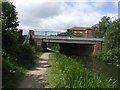
Pratts Mill Bridge - Wyrley and Essington Canal
On the Bloxwich Road north of Walsall.
Image: © John M
Taken: 22 Jun 2008
0.07 miles
2
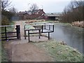
Towpath Barrier and Pratts Mill Bridge - Wyrley & Essington Canal
Bloxwich Road B4210
Image: © Adrian Rothery
Taken: 6 Feb 2007
0.09 miles
3
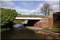
Pratts Mill Bridge, Wyrley & Essington Canal
Pratts Mill Bridge carries Bloxwich Road over the canal.
Image: © Stephen McKay
Taken: 6 Apr 2016
0.10 miles
4
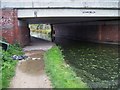
Pratts Mill Bridge - Wyrley & Essington Canal
Carries Bloxwich Road over the canal.
Displays the discarded remnants of a cable strippers workday.
Image: © Adrian Rothery
Taken: 20 Oct 2006
0.11 miles
5
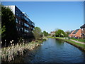
New housing along the Wyrley & Essington Canal
The flats are off Carl Street, the houses off Northumberland Way.
Image: © Christine Johnstone
Taken: 6 May 2018
0.13 miles
6
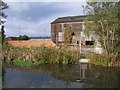
Disused Factory
Alongside the canal and to the west of Bloxwich Road.
Image: © Adrian Rothery
Taken: 20 Oct 2006
0.14 miles
7
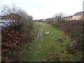
North Walsall railway station (site), West Midlands
Opened in 1872 by the Midland Railway and London & North Western Railway jointly on the line from Wolverhampton to Walsall, this station closed in 1925.
View west towards Bentley and Wolverhampton. The railway line closed completely in 1980 and the cutting in which the station was sited was being filled in when this image was taken.
Image: © Nigel Thompson
Taken: 25 Jan 2019
0.15 miles
8
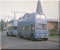
Walsall trolleybuses in Carl Street
Sunbeam F4A trolleybus 868 (XDH 68) is seen in Carl Street, WS2 7BE on the approach to Birchills Depot. It has Willowbrook 70-seater bodywork dating from 1956. Behind it is Crossley Empire TDD43/2 trolleybus 850 (HBE 541). The former Methodist Church can be seen to the right of the photo.
Image: © David Hillas
Taken: 20 Sep 1969
0.15 miles
9
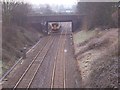
Forest Lane Bridge
A train passes under Forest Lane Bridge and heads for Rutland Street Bridge on its way to Walsall Station.
Image: © Adrian Rothery
Taken: 6 Feb 2007
0.16 miles
10
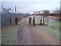
Towpath Barrier - Wyrley & Essington Canal
Situated between Pratts Mill Bridge (Bloxwich Road) and Green Lane Bridge.
Image: © Adrian Rothery
Taken: 6 Feb 2007
0.16 miles