
IMAGES TAKEN NEAR TO
Queen Elizabeth Avenue, WALSALL, WS2 0BG
Introduction
This page details the photographs taken nearby to Queen Elizabeth Avenue, WS2 0BG by members of the Geograph project.
The Geograph project started in 2005 with the aim of publishing, organising and preserving representative images for every square kilometre of Great Britain, Ireland and the Isle of Man.

There are currently over 7.5m images from over14,400 individuals and you can help contribute to the project by visiting https://www.geograph.org.uk
Image Map
Images are licensed for reuse under creativecommons.org/licenses/by-sa/2.0
Notes
- Clicking on the map will re-center to the selected point.
- The higher the marker number, the further away the image location is from the centre of the postcode.
Image Listing (26 Images Found)
Images are licensed for reuse under creativecommons.org/licenses/by-sa/2.0
Image
Details
Distance
2
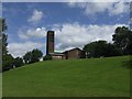
Emmanuel Church, Bentley
Perched in a commanding position on the edge of the hillock formerly occupied since Tudor times by manor houses and until the 1929 by Bentley Hall.
The church was constructed in 1956 to a design by Wolverhampton architect Richard Twentyman.
Image: © John M
Taken: 13 Jul 2008
0.09 miles
4
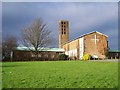
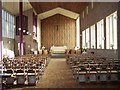
Emmanuel Church, Bentley
Church History: http://www.emmanuel-bentley.org/history.php
Image: © Geoff Pick
Taken: 26 Jan 2008
0.11 miles
5
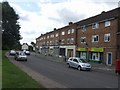
Bentley Shopping Centre
On Sunday morning the shops on Queen Elizabeth Avenue have the shutters down. Volunteers were cleaning graffiti off the shutters and litter picking on the roads into the estate. The shops in Bentley have suffered in recent years from the closure of the library and health centre.
Image: © John M
Taken: 13 Jul 2008
0.11 miles
6
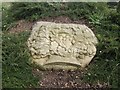
The Royal Oak - Bentley Cairn
Bentley Cairn marks the site of Bentley Hall and has a series of depictions of the escape of King Charles II after the Battle of Worcester.
The king hid in an oak tree near Boscobel House to avoid discovery by Parliamentary troopers before travelling to Bentley Hall.
This sculpture was installed as part of a Local History Initiative.
Image: © John M
Taken: 13 Jul 2008
0.12 miles
7
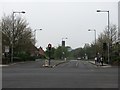
Queen Elizabeth Avenue
Looking over the junction with Wolverhampton Road West.
Image: © Richard Webb
Taken: 18 Apr 2011
0.13 miles
8
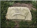
The Royal Crown - Bentley Cairn
Bentley Cairn marks the site of Bentley Hall and has a series of depictions of the escape of King Charles II after the Battle of Worcester in September 1651.
The king was restored to the throne in 1660.
This sculpture was installed as part of a Local History Initiative.
Image: © John M
Taken: 13 Jul 2008
0.13 miles
9
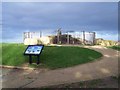
Bentley Cairn
The stone marks the site of three former manor houses, two of which were known as Bentley Hall.
Full history can be found at: http://www.walsall.gov.uk/index/leisure_and_culture/parks_and_countryside/bentley_cairn_the_secrets_of_the_stone.htm
Image: © Geoff Pick
Taken: 26 Jan 2008
0.14 miles
10
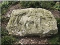
Monarch on the run - Bentley Cairn
Bentley Cairn marks the site of Bentley Hall and has a series of depictions of the escape of King Charles II after the Battle of Worcester.
A popular subject for paintings and etchings was mistress Jane Lane with the king as her manservant on their journey to Abbots Leigh near Bristol. Several of these are in the National Portrait Gallery and another in the Walsall Arts Gallery. This sculpture was installed as part of a Local History Initiative.
Image: © John M
Taken: 13 Jul 2008
0.14 miles