
IMAGES TAKEN NEAR TO
Churchill Road, WALSALL, WS2 0AW
Introduction
This page details the photographs taken nearby to Churchill Road, WS2 0AW by members of the Geograph project.
The Geograph project started in 2005 with the aim of publishing, organising and preserving representative images for every square kilometre of Great Britain, Ireland and the Isle of Man.

There are currently over 7.5m images from over14,400 individuals and you can help contribute to the project by visiting https://www.geograph.org.uk
Image Map
Images are licensed for reuse under creativecommons.org/licenses/by-sa/2.0
Notes
- Clicking on the map will re-center to the selected point.
- The higher the marker number, the further away the image location is from the centre of the postcode.
Image Listing (22 Images Found)
Images are licensed for reuse under creativecommons.org/licenses/by-sa/2.0
Image
Details
Distance
1
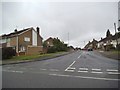
Morris Avenue
The view from Churchill Road in Willenhall, Walsall.
Image: © Gordon Griffiths
Taken: 29 May 2014
0.05 miles
3
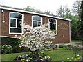
St Andrew's
Free Church of England. (I did not know that there was one in the south too). Situated at the western end of Churchill Road.
Image: © Richard Webb
Taken: 18 Apr 2011
0.11 miles
4
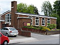
St Andrew's Free Church of England, Willenhall
This lies at the junction of the B4464 Wolverhampton Road West, and Churchill Road
Image: © Richard Law
Taken: 7 Jul 2010
0.12 miles
5
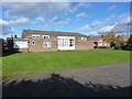
Bentley Methodist Church
Just off Margaret Road in Bentley
Image: © Richard Law
Taken: 2 Nov 2012
0.14 miles
6
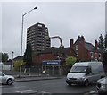
At last! a disappearing geograph
I have waited seven months for the end of this particular tower block near Willenhall Image I thought that this would have been brought down by explosives but this seems to be the currently preferred method.
Image: © John M
Taken: 15 May 2007
0.14 miles
7
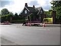
Bentley Cemetery Gates
B4464 Wolverhampton Road West.
Bentley Cemetery was opened in 1900 by the then Willenhall Urban District Council.
Image: © Adrian Rothery
Taken: 14 Aug 2008
0.15 miles
8
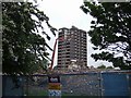
Gone at last! the disappeared geograph
The front block of this pair of towerblocks has been reduced to a pile of rubble. I have been waiting over seven months to see them go. Image
Image: © John M
Taken: 15 May 2007
0.15 miles
9
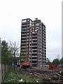
Carefully does it!
The neighbouring property seems very close. This is the second of a pair of towerblocks that have been standing empty for more than six months.
Image: © John M
Taken: 15 May 2007
0.15 miles
10
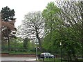
Wolverhampton Road West
The junction with Churchill Road with Bentley Cemetery in the background.
Image: © Richard Webb
Taken: 18 Apr 2011
0.16 miles