1
The Poplars, Handsacre
Sadly, this pub closed for the last time in early 2008
Image: © Geoff Pick
Taken: 16 May 2008
0.08 miles
2
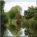
Canal east of Handsacre in Staffordshire
This is the Trent and Mersey Canal, looking north-west of Royles Bridge, No 57.
Image: © Roger D Kidd
Taken: 5 Oct 2017
0.09 miles
3
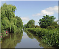
Trent & Mersey Canal towards bridge #57
Image: © Ian S
Taken: 18 Jan 2022
0.10 miles
4
Canal east of Handsacre in Staffordshire
This is the Trent and Mersey Canal, north-west of Royles Bridge, No 57.
Image: © Roger D Kidd
Taken: 5 Oct 2017
0.10 miles
5
Trent and Mersey Canal near Handsacre, Staffordshire
The weather this autumn has been warm and mainly dry in the Midlands in 2011 (not elsewhere in the west or north of the British Isles!). Foliage is showing reluctant signs of autumnal colouring, but the heavily fruit laden hawthorn trees make up for it.
Image: © Roger D Kidd
Taken: 20 Oct 2011
0.10 miles
6
Trent and Mersey Canal near Handsacre, Staffordshire
The weather this autumn has been warm and mainly dry in the Midlands in 2011 (not elsewhere in the west or north of the British Isles!). Foliage is showing reluctant signs of autumnal colouring, but the heavily fruit laden hawthorn trees make up for it.
Image: © Roger D Kidd
Taken: 20 Oct 2011
0.11 miles
7
Trent and Mersey Canal east of Handsacre in Staffordshire
This shows the Trent and Mersey Canal north of Tuppenhurst Bridge, No 57.
Image: © Roger Kidd
Taken: 20 Oct 2011
0.11 miles
8
Trent and Mersey Canal east of Handsacre, Staffordshire
Here the canal is skirting the eastern boundary of Handsacre's built up area, just off camera to the left.
Image: © Roger D Kidd
Taken: 20 Jun 2010
0.11 miles
9
Trent and Mersey Canal east of Handsacre, Staffordshire
Here the canal is skirting the eastern boundary of Handsacre's built up area, just off camera to the left.
The canal was built during the years 1766 and 1777, originally surveyed and engineered by James Brindley, who died in 1772.
Image: © Roger D Kidd
Taken: 20 Jun 2010
0.11 miles
10
Trent & Mersey Canal Milepost along the towpath
Along the canal at Handsacre.
Image, for the previous milepost.
Image, for the next milepost along the canal.
Image: © Mat Fascione
Taken: 27 Jun 2015
0.12 miles


