
IMAGES TAKEN NEAR TO
Handsacre Crescent, RUGELEY, WS15 4DQ
Introduction
This page details the photographs taken nearby to Handsacre Crescent, WS15 4DQ by members of the Geograph project.
The Geograph project started in 2005 with the aim of publishing, organising and preserving representative images for every square kilometre of Great Britain, Ireland and the Isle of Man.

There are currently over 7.5m images from over14,400 individuals and you can help contribute to the project by visiting https://www.geograph.org.uk
Image Map
Images are licensed for reuse under creativecommons.org/licenses/by-sa/2.0
Notes
- Clicking on the map will re-center to the selected point.
- The higher the marker number, the further away the image location is from the centre of the postcode.
Image Listing (9 Images Found)
Images are licensed for reuse under creativecommons.org/licenses/by-sa/2.0
Image
Details
Distance
2
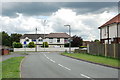
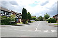
Shropshire Brook Road, Handsacre
The junction with Manor Court Drive is in the foreground in this area of relatively new housing on the southern edge of Handsacre. Cannock Chase can be seen in the distance.
Image: © Stephen McKay
Taken: 23 Feb 2023
0.12 miles
3
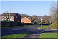
Sleeping policeman on Shropshire Brook Road, Armitage
Traffic calming at the point where the road crosses a watercourse.
Image: © Christine Johnstone
Taken: 2 Dec 2018
0.18 miles
4
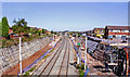
West Coast Main Line at site of Armitage station, widening work 2006
View NW from the A513 bridge at Handsacre, towards Stafford, Crewe etc.: ex-LNWR WCML, at the site of Armitage station which was closed 13/6/60 (goods 6/1/69) in order to ease capacity on the relatively short stretches of only double-track of the WCML south of Crewe. Here in 2006 quadrupling between Tamworth and Rugeley is in progress.
Image: © Ben Brooksbank
Taken: 24 Jul 2006
0.21 miles
6
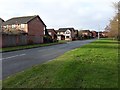
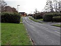
Shropshire Brook Road, Armitage
Looking west.
Image: © Christine Johnstone
Taken: 2 Dec 2018
0.23 miles
7
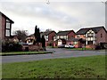
Detached houses in Hazel Drive, Armitage
On the south side of Shropshire Brook Road.
Image: © Christine Johnstone
Taken: 2 Dec 2018
0.23 miles
8
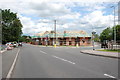
New Housing Complex, Handsacre
This new building site is on the junction of the Lichfield road and the B5014 Uttoxeter road.
Image: © Mick Malpass
Taken: 29 Jun 2011
0.24 miles
9
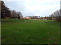
Playing fields with at least two football pitches, Armitage
On the north side of Shropshire Brook Road. The distant building is a doctors' surgery.
Image: © Christine Johnstone
Taken: 2 Dec 2018
0.25 miles