
IMAGES TAKEN NEAR TO
Bardy Lane, RUGELEY, WS15 4AW
Introduction
This page details the photographs taken nearby to Bardy Lane, WS15 4AW by members of the Geograph project.
The Geograph project started in 2005 with the aim of publishing, organising and preserving representative images for every square kilometre of Great Britain, Ireland and the Isle of Man.

There are currently over 7.5m images from over14,400 individuals and you can help contribute to the project by visiting https://www.geograph.org.uk
Image Map
Images are licensed for reuse under creativecommons.org/licenses/by-sa/2.0
Notes
- Clicking on the map will re-center to the selected point.
- The higher the marker number, the further away the image location is from the centre of the postcode.
Image Listing (14 Images Found)
Images are licensed for reuse under creativecommons.org/licenses/by-sa/2.0
Image
Details
Distance
1

Bardy Lane towards Armitage
Not a good idea to come down this lane, not enough room to open the car doors to take the photograph, hope nothing is coming the other way.
Image: © Mick Malpass
Taken: 29 Jun 2011
0.08 miles

3

Rectory Lane
Heading south west from Armitage.
Image: © JThomas
Taken: 25 Mar 2017
0.13 miles

5

Bardy Lane, heading south-west from Armitage
Despite the traffic sign, it would be a very foolish driver indeed who did more than 30mph on this single-track road.
Image: © Christine Johnstone
Taken: 2 Dec 2018
0.16 miles

7

Houses on Upper Lodge Road, Armitage
View across the field from Rectory Lane.
Image: © JThomas
Taken: 25 Mar 2017
0.18 miles

9

Bend in Bardy Lane
Heading south towards Brereton Cross.
Image: © JThomas
Taken: 25 Mar 2017
0.19 miles
10
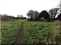
Well-used footpath heading south-west from Rectory Lane
On the outskirts of Armitage. Not mapped as a public footpath.
Image: © Christine Johnstone
Taken: 2 Dec 2018
0.19 miles