
IMAGES TAKEN NEAR TO
Church Lane, RUGELEY, WS15 3QF
Introduction
This page details the photographs taken nearby to Church Lane, WS15 3QF by members of the Geograph project.
The Geograph project started in 2005 with the aim of publishing, organising and preserving representative images for every square kilometre of Great Britain, Ireland and the Isle of Man.

There are currently over 7.5m images from over14,400 individuals and you can help contribute to the project by visiting https://www.geograph.org.uk
Image Map
Images are licensed for reuse under creativecommons.org/licenses/by-sa/2.0
Notes
- Clicking on the map will re-center to the selected point.
- The higher the marker number, the further away the image location is from the centre of the postcode.
Image Listing (23 Images Found)
Images are licensed for reuse under creativecommons.org/licenses/by-sa/2.0
Image
Details
Distance
1
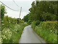
Church Lane, Hill Ridware
The church is in the hamlet of Mavesyn Ridware rather than what is now the main village of Hill Ridware.
Image: © Alan Murray-Rust
Taken: 6 Jun 2021
0.03 miles

3

Footpath to the fishing lake
One of a considerable number of footpaths in the area between the Ridware villages and Rugeley. The lake is a flash caused by coal mining subsidence.
Image: © Alan Murray-Rust
Taken: 6 Jun 2021
0.09 miles
4
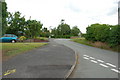
Church Lane Junction with Ridware Road, Hill Ridware
Image: © Mick Malpass
Taken: 29 Jun 2011
0.13 miles


7

Hill Ridware
The Chadwick Arms is on the left
Image: © Geoff Pick
Taken: 17 Jul 2006
0.19 miles
8
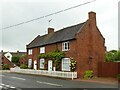
The School House, Hill Ridware
Mid 18th house, probably the former schoolmaster's house, Listed Grade II.
Image: © Alan Murray-Rust
Taken: 6 Jun 2021
0.20 miles
9

Ridware Hall, Hill Ridware
Late 18th century house, Listed Grade II, seen from the south.
Image: © Alan Murray-Rust
Taken: 6 Jun 2021
0.21 miles
