
IMAGES TAKEN NEAR TO
Burnthill Lane, RUGELEY, WS15 2HU
Introduction
This page details the photographs taken nearby to Burnthill Lane, WS15 2HU by members of the Geograph project.
The Geograph project started in 2005 with the aim of publishing, organising and preserving representative images for every square kilometre of Great Britain, Ireland and the Isle of Man.

There are currently over 7.5m images from over14,400 individuals and you can help contribute to the project by visiting https://www.geograph.org.uk
Image Map
Images are licensed for reuse under creativecommons.org/licenses/by-sa/2.0
Notes
- Clicking on the map will re-center to the selected point.
- The higher the marker number, the further away the image location is from the centre of the postcode.
Image Listing (3 Images Found)
Images are licensed for reuse under creativecommons.org/licenses/by-sa/2.0
Image
Details
Distance
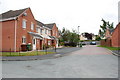
2
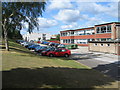
Hagley Park Sports College, Rugeley, Staffordshire
A specialist status sports college, situated on Burnthill Lane. It has just over 800 students aged 11-16 on site; with its sixth form being educated at the Aelfgar Centre, which is about a mile away in the town of Rugeley. The school will celebrate its 50th anniversary in September 2006. The light coloured buildings were added in the 1970s.
Image: © Alan Slater
Taken: 11 Jul 2006
0.19 miles
3
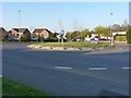
A mini roundabout on the Hednesford Road
On the approach into Rugeley from the southwest, this roundabout slows the traffic coming in on the A460.
Image: © Richard Law
Taken: 2 May 2013
0.20 miles