
IMAGES TAKEN NEAR TO
Heron Street, RUGELEY, WS15 2DZ
Introduction
This page details the photographs taken nearby to Heron Street, WS15 2DZ by members of the Geograph project.
The Geograph project started in 2005 with the aim of publishing, organising and preserving representative images for every square kilometre of Great Britain, Ireland and the Isle of Man.

There are currently over 7.5m images from over14,400 individuals and you can help contribute to the project by visiting https://www.geograph.org.uk
Image Map
Images are licensed for reuse under creativecommons.org/licenses/by-sa/2.0
Notes
- Clicking on the map will re-center to the selected point.
- The higher the marker number, the further away the image location is from the centre of the postcode.
Image Listing (144 Images Found)
Images are licensed for reuse under creativecommons.org/licenses/by-sa/2.0
Image
Details
Distance
2
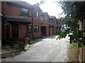
Keystone Road, Rugeley
In my childhood, this was Keystone Lane, but it has morphed into Keystone Road. On this site the Key family had a factory. Now there is a small housing development, Keystone Mews.
In the late 1870s John Key had a draper’s shop in nearby Lower Brook Street.In 1888 his son George set up his own business on the second floor. Later that year George introduced a new type of coat made of thick, hard-wearing material, which he had developed for the navvies who were building the Manchester Ship Canal. The coat became known as the Donkey Jacket – named after the ‘donkey engines’ that some of the navvies worked on. The mail order business, now so popular, was pioneered by George Key through his catalogue, The Keystone. Ladies’ clothes were sold by mail order after the First World War, and the firm lasted until 1984.
The Wikipedia entry for donkey jacket tells none of this. I obtained it from a local heritage site for Rugeley so I hope it's accurate.
Image: © Tricia Neal
Taken: 19 Oct 2013
0.05 miles
3
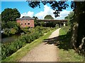
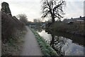
Canal bridges
The Trent and Mersey Canal at Rugeley.
Image: © Patrick Mackie
Taken: 28 Aug 2006
0.07 miles
5
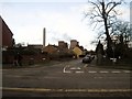
Heron Street, Rugeley
Taken outside a house called Heron's Nest, at the end of Albion Street. Heron Street is going directly away from me, with the power station in the distance. The yellow gable wall is No. 35, where my granny and grandad lived many moons ago.
Image: © Tricia Neal
Taken: 24 Dec 2013
0.08 miles
7
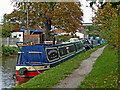
Moored narrowboats in Rugeley, Staffordshire
There are excellent visitor mooring facilities on the Trent and Mersey Canal in Rugeley.
Image: © Roger Kidd
Taken: 2 Oct 2017
0.08 miles
8
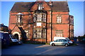
A Grand Billiards Club
Rugeley Billiards Club on Heron Street is in a magnificent old house that to me looks like an old manor house.
Image: © Stephen Pearce
Taken: 7 Nov 2006
0.09 miles
9
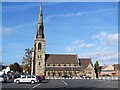
SS Joseph & Etheldreda Catholic Church, Rugeley
GENUKI notes: The Roman Catholic Church at Rugeley is dedicated to Saints Joseph & Etheldreda, and was erected in 1849-50, in the decorated style of architecture. The exterior is of white stone, and the interior is of Bath stone.
Image: © Geoff Pick
Taken: 16 Oct 2009
0.09 miles
10
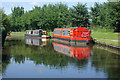
Trent & Mersey Canal, Rugeley
Two narrowboats are moored close to the railway bridge.
Image: © Stephen McKay
Taken: 16 Aug 2013
0.09 miles