
IMAGES TAKEN NEAR TO
Lower Brook Street, RUGELEY, WS15 2BZ
Introduction
This page details the photographs taken nearby to Lower Brook Street, WS15 2BZ by members of the Geograph project.
The Geograph project started in 2005 with the aim of publishing, organising and preserving representative images for every square kilometre of Great Britain, Ireland and the Isle of Man.

There are currently over 7.5m images from over14,400 individuals and you can help contribute to the project by visiting https://www.geograph.org.uk
Image Map
Images are licensed for reuse under creativecommons.org/licenses/by-sa/2.0
Notes
- Clicking on the map will re-center to the selected point.
- The higher the marker number, the further away the image location is from the centre of the postcode.
Image Listing (117 Images Found)
Images are licensed for reuse under creativecommons.org/licenses/by-sa/2.0
Image
Details
Distance
2
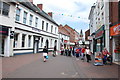
Lower Brook Street, Rugeley.
The Building called "Seconds Ahead" on the left hand side, was the old Lloyds Bank. It is hard to believe that large lorries and cars used to use this road before the bypass was built.
Image: © Mick Malpass
Taken: 2 Jun 2011
0.01 miles
3
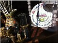
Mementos of the 1984-85 miners' strike, in shop window, Rugeley
Image: © A J Paxton
Taken: 8 Aug 2020
0.02 miles
4
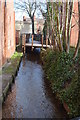
Brook
The brook provided power to flour mills, forges and tanneries. The mill ponds have been filled in to provide car parking.
Image: © John M
Taken: 2 Feb 2014
0.03 miles
5
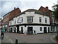
The Vaults Pub, Rugeley
Market Square RUGELEY WS15 2BL close to The Trent and Mersey Canal
Image: © canalandriversidepubs co uk
Taken: 9 Jun 2010
0.03 miles
7
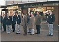
Rugeley's Act of Remembrance 1984
This was taken in 1984 by my father with my camera; I am the subject playing the bugle (badly) at the cenotaph when it was located in Brook Square. The cenotaph was moved back to its original location in Anson Street after the completion of the building of Penny Bank Flats (the old town hall site). At this time I was a member of the Rugeley Branch Staffordshire Regiment Association.
Image: © Philip Parkes
Taken: 11 Nov 1984
0.05 miles
8

The Albion PH
Another Bank's pub rebranded as Marstons.
Image: © John M
Taken: 2 Feb 2014
0.05 miles
9

The Albion PH sign
Albion was used by Pliny the Elder for the mainland of Britain. The name may derive from the white cliffs at Dover.
Image: © John M
Taken: 2 Feb 2014
0.05 miles
10
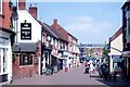
Rugeley
Upper Brook Street, leading into the town centre, showing "The Crown Inn".
Image: © www fotodiscs4u co uk
Taken: 11 Nov 2006
0.05 miles