
IMAGES TAKEN NEAR TO
Bush Drive, RUGELEY, WS15 2AQ
Introduction
This page details the photographs taken nearby to Bush Drive, WS15 2AQ by members of the Geograph project.
The Geograph project started in 2005 with the aim of publishing, organising and preserving representative images for every square kilometre of Great Britain, Ireland and the Isle of Man.

There are currently over 7.5m images from over14,400 individuals and you can help contribute to the project by visiting https://www.geograph.org.uk
Image Map
Images are licensed for reuse under creativecommons.org/licenses/by-sa/2.0
Notes
- Clicking on the map will re-center to the selected point.
- The higher the marker number, the further away the image location is from the centre of the postcode.
Image Listing (21 Images Found)
Images are licensed for reuse under creativecommons.org/licenses/by-sa/2.0
Image
Details
Distance
1
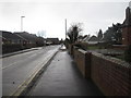
Fortescue Lane, Rugeley
Taken from the corner of Church Street, looking along Fortescue Lane away from the town centre. The wall on the right surrounds a block of alms houses.
Image: © Tricia Neal
Taken: 24 Dec 2013
0.09 miles
2
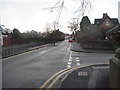
Church Street, Rugeley
Looking towards Western Springs Road, with Fortescue Lane going off on my right.
Image: © Tricia Neal
Taken: 24 Dec 2013
0.10 miles
3
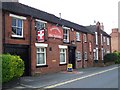
The Prince of Wales, Rugeley
In Church Street
Image: © Geoff Pick
Taken: 25 May 2009
0.10 miles
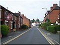
5
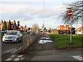
Western Springs Road, Rugeley
This view is looking away from Rugeley. The junction with traffic lights is made by Hagley Road coming in on the left, and Church Street going away to the right. The strip of road in the foreground with the "No Entry" sign is the exit from Sheep Fair.
Image: © Tricia Neal
Taken: 24 Dec 2013
0.13 miles
6
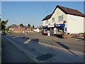
Hagley News
Newsagent and local store at the junction of Hagley Road and Western Springs Road, the A460, through Rugeley.
Image: © Richard Law
Taken: 2 May 2013
0.14 miles
7
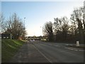
Western Springs Road, Rugeley
This road was named after Western Springs, America, with which town Rugeley is "twinned". The view is looking along towards the town and Horse Fair.
Image: © Tricia Neal
Taken: 24 Dec 2013
0.19 miles
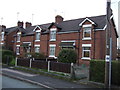
9
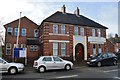
Victory Church
Former Drill Hall of D Company 6th North Staffordshire Regiment.
Image: © John M
Taken: 2 Feb 2014
0.21 miles
10
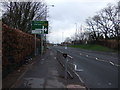
Western Springs Road (A460)
Towards Stone and Stafford.
Image: © JThomas
Taken: 19 Apr 2013
0.21 miles