
IMAGES TAKEN NEAR TO
Booth Hurst Road, RUGELEY, WS15 1RP
Introduction
This page details the photographs taken nearby to Booth Hurst Road, WS15 1RP by members of the Geograph project.
The Geograph project started in 2005 with the aim of publishing, organising and preserving representative images for every square kilometre of Great Britain, Ireland and the Isle of Man.

There are currently over 7.5m images from over14,400 individuals and you can help contribute to the project by visiting https://www.geograph.org.uk
Image Map
Images are licensed for reuse under creativecommons.org/licenses/by-sa/2.0
Notes
- Clicking on the map will re-center to the selected point.
- The higher the marker number, the further away the image location is from the centre of the postcode.
Image Listing (54 Images Found)
Images are licensed for reuse under creativecommons.org/licenses/by-sa/2.0
Image
Details
Distance
1
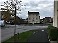
Bend in Priory Avenue
New estate on the south east edge of Rugeley.
Image: © David Lally
Taken: 8 Oct 2017
0.04 miles
2

Drain for new housing
Like many new housing estates it appears that surface water drainage is to a constructed storage pond in which reeds are encouraged.
Image: © David Lally
Taken: 8 Oct 2017
0.13 miles

4
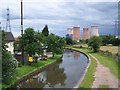
View From A513 Bridge
The Ash Tree pub is on the left and Rugeley Power Station can be seen in the distance
Image: © Geoff Pick
Taken: 13 Jun 2008
0.21 miles
5
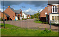
St Thomas Way near Brereton in Staffordshire
St Thomas Way in Brereton east of Rugeley is seen here from a passing narrowboat on the Trent and Mersey Canal.
Currently, Streetview images of this estate don't exist, the most recent being around Priory Avenue to the north-west, dated 2011, and showing development in progress.
Image: © Roger D Kidd
Taken: 5 Oct 2017
0.21 miles
6

Trent and Mersey Canal near Brereton in Staffordshire
This is the Trent and Mersey Canal east of Rugeley, looking east towards Handsacre.
The moorings here are long-term; visitors use the towpath side.
Image: © Roger D Kidd
Taken: 5 Oct 2017
0.21 miles
7
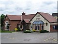
The Ash Tree, Brereton
Gutted by fire a few years ago, this is now a popular eating house on the canal bank
Image: © Geoff Pick
Taken: 13 Jun 2008
0.21 miles
8

Trent and Mersey Canal near Rugeley in Staffordshire
Looking west-north-west towards Rugeley and Great Haywood.
Image: © Roger Kidd
Taken: 20 Jun 2010
0.22 miles
9

Moored narrowboats near Armitage in Staffordshire
Looking west-north-west towards Rugeley and Great Haywood.
Image: © Roger Kidd
Taken: 20 Jun 2010
0.22 miles
