
IMAGES TAKEN NEAR TO
Power Station Road, RUGELEY, WS15 1NZ
Introduction
This page details the photographs taken nearby to Power Station Road, WS15 1NZ by members of the Geograph project.
The Geograph project started in 2005 with the aim of publishing, organising and preserving representative images for every square kilometre of Great Britain, Ireland and the Isle of Man.

There are currently over 7.5m images from over14,400 individuals and you can help contribute to the project by visiting https://www.geograph.org.uk
Image Map
Images are licensed for reuse under creativecommons.org/licenses/by-sa/2.0
Notes
- Clicking on the map will re-center to the selected point.
- The higher the marker number, the further away the image location is from the centre of the postcode.
Image Listing (81 Images Found)
Images are licensed for reuse under creativecommons.org/licenses/by-sa/2.0
Image
Details
Distance

2

Amazon Distribution Centre
Amazon signed a 15 year lease on this 700000 sq ft warehouse in 2011 on the site of the former Lea Hall colliery.
Jobs have recently been likened to working as human robots. Many of the jobs are temporary or on zero hours contracts through agencies. This may be a case that any job is better than none if only marginally.
Image: © John M
Taken: 2 Feb 2014
0.08 miles
3

Trent & Mersey Canal milepost in Rugeley
Image, for a view of the previous milepost along the canal.
Image, for the next milepost along the canal.
Image: © Mat Fascione
Taken: 27 Jun 2015
0.09 miles
4

Trent and Mersey Canal near Rugeley, Staffordshire
The canal is 93.5 miles in length from Derwent Mouth to Preston Brook. The first sod was cut by Josiah Wedgwood in July 1766 at Middleport (Stoke-on-Trent). It took eleven years to build. This section between Derwent Mouth and Shugborough (the junction with the Staffordshire and Worcestershire Canal) was operational by 1770. James Brindley was the engineer until his death in 1772.
Staffordshire's "Way for the Millennium" long distance footpath utilises the towpath between here and Great Haywood.
Image: © Roger D Kidd
Taken: 22 Oct 2009
0.10 miles
5

Amazon distribution centre
Amazon distribution centre at Rugeley.
Image: © Philip Halling
Taken: 17 May 2018
0.10 miles
6

Canal milemarker by the Trent & Mersey Canal, Mossley
Replica Milemarker by the Trent & Mersey Canal, in parish of Brereton and Ravenhill (Cannock Chase District), Mossley.
Inscription reads:-
: SHARDLOW / 32 / MILES : : PRESTON BROOK / 60 / MILES :
Sponsor:-
: 19 / T&MCS / 77 :
Milestone Society National ID: TMC-32
Image: © Milestone Society
Taken: Unknown
0.11 miles
7

Trent and Mersey Canal near Rugeley in Staffordshire
Rugeley is to the left of the canal, which acts as its boundary. To the right is Rugeley Power Station, but the canal wends its way very quietly between those two places on this dull autumn morning.
Image: © Roger D Kidd
Taken: 22 Oct 2009
0.11 miles
8
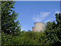
Treetops and cooling towers near Rugeley, Staffordshire
Viewed from a passing narrowboat on the Trent and Mersey Canal south-east of Mossley Bridge, No 65.
There is an open semi-wooded area by the canal here, above which two of the four cooling towers of Rugeley Power Station can be seen.
Update: The cooling towers were demolished on 6 June 2021. Other infrastructure was demolished earlier, including the chimney on 24th January 2021.
Image: © Roger D Kidd
Taken: 17 Jul 2016
0.11 miles
9

Trent and Mersey Canal near Rugeley, Staffordshire
Looking south-east towards Armitage and Handsacre.
Image: © Roger D Kidd
Taken: 17 Jul 2016
0.11 miles
10

Trent & Mersey canal in Brereton, Rugeley
With the Way for the Millennium sharing the towpath and a giant Amazon building unseen beyond the towpath.
Image: © Christine Johnstone
Taken: 2 May 2022
0.12 miles