IMAGES TAKEN NEAR TO
Ashtree Bank, RUGELEY, WS15 1HN
Introduction
This page details the photographs taken nearby to Ashtree Bank, WS15 1HN by members of the Geograph project.
The Geograph project started in 2005 with the aim of publishing, organising and preserving representative images for every square kilometre of Great Britain, Ireland and the Isle of Man.

There are currently over 7.5m images from over14,400 individuals and you can help contribute to the project by visiting https://www.geograph.org.uk
Image Map
Images are licensed for reuse under creativecommons.org/licenses/by-sa/2.0
Notes
- Clicking on the map will re-center to the selected point.
- The higher the marker number, the further away the image location is from the centre of the postcode.
Image Listing (40 Images Found)
Images are licensed for reuse under creativecommons.org/licenses/by-sa/2.0
Image
Details
Distance
2
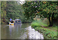
Trent and Mersey Canal near Brereton, Staffordshire
The canal is 93.5 miles in length from Derwent Mouth to Preston Brook. The first sod was cut by Josiah Wedgwood in July 1766 at Middleport (Stoke-on-Trent). It took eleven years to build. This section between Derwent Mouth and Shugborough (the junction with the Staffordshire and Worcestershire Canal) was operational by 1770. James Brindley was the engineer until his death in 1772.
Staffordshire's "Way for the Millennium" long distance footpath utilises the towpath between here and Great Haywood.
Image: © Roger D Kidd
Taken: 22 Oct 2009
0.10 miles
3
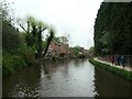
Out for a walk on the canal towpath
The Trent & Mersey canal at the southern edge of Rugeley.
Image: © Christine Johnstone
Taken: 2 May 2022
0.10 miles
4
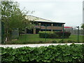
Canalside premises, Towers Business Park, Rugeley
It could be a wheel and tyre supplier, a pipe supplier or an IT company - they are all listed close by. The business park is on the site of a demolished power station.
Image: © Christine Johnstone
Taken: 2 May 2022
0.11 miles
6

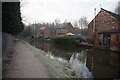
Old buildings by the canal near Brereton, Staffordshire
This old wharf with its buildings will surely be demolished and redeveloped before long. It was a former brewery (see Victorian maps).
Image: © Roger D Kidd
Taken: 20 Jun 2010
0.13 miles
7

Old canalside buildings near Brereton, Staffordshire
This is a close look at this site by the Trent and Mersey Canal:
Image]
Image: © Roger Kidd
Taken: 20 Jun 2010
0.13 miles
8
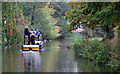
Trent and Mersey Canal near Brereton, Staffordshire
The canal is 93.5 miles in length from Derwent Mouth to Preston Brook. The first sod was cut by Josiah Wedgwood in July 1766 at Middleport (Stoke-on-Trent). It took eleven years to build. This section between Derwent Mouth and Shugborough (the junction with the Staffordshire and Worcestershire Canal) was operational by 1770. James Brindley was the engineer until his death in 1772.
Image: © Roger D Kidd
Taken: 22 Oct 2009
0.14 miles
9

Canal near Ravenhill Park in Rugeley, Staffordshire
This is the Trent and Mersey Canal, looking north-west towards the town centre. Victorian maps show the old buildings on the left were part of a brewery fronting onto Armitage Road.
Image: © Roger Kidd
Taken: 22 Jul 2016
0.14 miles