
IMAGES TAKEN NEAR TO
Armitage Road, RUGELEY, WS15 1BZ
Introduction
This page details the photographs taken nearby to Armitage Road, WS15 1BZ by members of the Geograph project.
The Geograph project started in 2005 with the aim of publishing, organising and preserving representative images for every square kilometre of Great Britain, Ireland and the Isle of Man.

There are currently over 7.5m images from over14,400 individuals and you can help contribute to the project by visiting https://www.geograph.org.uk
Image Map
Images are licensed for reuse under creativecommons.org/licenses/by-sa/2.0
Notes
- Clicking on the map will re-center to the selected point.
- The higher the marker number, the further away the image location is from the centre of the postcode.
Image Listing (65 Images Found)
Images are licensed for reuse under creativecommons.org/licenses/by-sa/2.0
Image
Details
Distance
1

Treetops and chimney near Rugeley, Staffordshire
Viewed from a passing narrowboat on the Trent and Mersey Canal south-east of Mossley Bridge, No 65.
There is an open semi-wooded area by the canal here, above which the 600 foot high chimney of Rugeley Power Station can be seen.
Image: © Roger D Kidd
Taken: 17 Jul 2016
0.06 miles
2
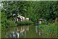
Trent and Mersey Canal approaching Rugeley in Staffordshire
2013 image.
On the left is the premises of the Brereton Community Hub in Armitage Road and by the Trent and Mersey Canal. It used to be the Ravenhill Ward Social Club until 2015.
Image: © Roger Kidd
Taken: 30 Aug 2013
0.08 miles
3

Trent and Mersey Canal approaching Rugeley in Staffordshire
Looking north-west towards Rugeley town centre. Armitage Road is off to the left.
Image: © Roger Kidd
Taken: 20 Jun 2010
0.08 miles
4

Trent and Mersey Canal near Rugeley, Staffordshire
Looking south-east towards Armitage and Handsacre.
Image: © Roger D Kidd
Taken: 17 Jul 2016
0.08 miles
5
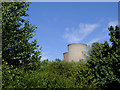
Treetops and cooling towers near Rugeley, Staffordshire
Viewed from a passing narrowboat on the Trent and Mersey Canal south-east of Mossley Bridge, No 65.
There is an open semi-wooded area by the canal here, above which two of the four cooling towers of Rugeley Power Station can be seen.
Update: The cooling towers were demolished on 6 June 2021. Other infrastructure was demolished earlier, including the chimney on 24th January 2021.
Image: © Roger D Kidd
Taken: 17 Jul 2016
0.08 miles
6
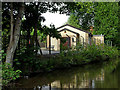
Clubhouse in Armitage Road in Rugeley, Staffordshire
2013 image.
This is the now the premises of the Brereton Community Hub in Armitage Road and by the Trent and Mersey Canal. It used to be the Ravenhill Ward Social Club until 2015.
Image: © Roger Kidd
Taken: 30 Aug 2013
0.08 miles
7

Trent and Mersey Canal approaching Rugeley in Staffordshire
Looking north-west towards Rugeley town centre. Armitage Road is off to the left.
The building housed the Ravenhill Ward Social Club until 2015, then the Brereton Community Hub.
Image: © Roger Kidd
Taken: 20 Jun 2010
0.09 miles
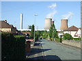

10

Bridge 65, Trent & Mersey Canal
Despite the rustic appearance this location is within the Rugeley town area.
Image: © Stephen McKay
Taken: 16 Aug 2013
0.12 miles