
IMAGES TAKEN NEAR TO
Walsall Road, LICHFIELD, WS14 0BY
Introduction
This page details the photographs taken nearby to Walsall Road, WS14 0BY by members of the Geograph project.
The Geograph project started in 2005 with the aim of publishing, organising and preserving representative images for every square kilometre of Great Britain, Ireland and the Isle of Man.

There are currently over 7.5m images from over14,400 individuals and you can help contribute to the project by visiting https://www.geograph.org.uk
Image Map
Images are licensed for reuse under creativecommons.org/licenses/by-sa/2.0
Notes
- Clicking on the map will re-center to the selected point.
- The higher the marker number, the further away the image location is from the centre of the postcode.
Image Listing (10 Images Found)
Images are licensed for reuse under creativecommons.org/licenses/by-sa/2.0
Image
Details
Distance
1

Lichfield Road looking back towards Walsall
A dangerous spot to tend a flower bed with traffic rushing by: this looks like a private initiative.
Image: © John M
Taken: 28 Jan 2007
0.06 miles
2
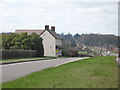
Formerly the Red, White and Blue PH
Now a residential property (and recently sold by the looks of the sign).
Image: © Adrian Rothery
Taken: 24 Mar 2009
0.09 miles
3

Former Garage, now a shop.
Typical of the small garages that relied upon repairs, MOTs and fuel sales to passing traffic. This one was on the Walsall to Lichfield road and is now used as a Motor Spares factor.
Image: © John M
Taken: 28 Jan 2007
0.14 miles
4

Looking to Junction of Lichfield Road (A461) and Barracks Lane.
Image: © Mick Malpass
Taken: 4 Jun 2011
0.15 miles
5
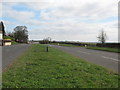
Junction of Walsall Road (A461) and Whitacre Lane
Image: © Adrian Rothery
Taken: 24 Mar 2009
0.18 miles
6

Junction of Lichfield Road (A461) and Barracks Lane
Image: © Adrian Rothery
Taken: 24 Mar 2009
0.19 miles

8

Lowood Cottage
At the junction of Barracks Lane with the Walsall to Lichfield Road the cottage dates from 1854. This was the time of expansion in the coal mining industry in Brownhills and South Staffordshire.
Image: © John M
Taken: 28 Jan 2007
0.21 miles
9

Sandhills Pumping Station
A 1935 built South Staffordshire Waterworks Company electrically powered pumping station.
SSWCo had steam, diesel and electric powered pumping stations and examples of all three forms of motive power survive but only electricity is used as the primary pumping power. Some stations have modern diesel generators as backup.
Image: © Chris Allen
Taken: 24 Jun 2006
0.24 miles
10

Sandhills Pumping Station with Staff Housing on Cartersfield Lane
Image: © Mick Malpass
Taken: 11 Feb 2012
0.25 miles