
IMAGES TAKEN NEAR TO
Walsall Road, LICHFIELD, WS13 8AH
Introduction
This page details the photographs taken nearby to Walsall Road, WS13 8AH by members of the Geograph project.
The Geograph project started in 2005 with the aim of publishing, organising and preserving representative images for every square kilometre of Great Britain, Ireland and the Isle of Man.

There are currently over 7.5m images from over14,400 individuals and you can help contribute to the project by visiting https://www.geograph.org.uk
Image Map
Images are licensed for reuse under creativecommons.org/licenses/by-sa/2.0
Notes
- Clicking on the map will re-center to the selected point.
- The higher the marker number, the further away the image location is from the centre of the postcode.
Image Listing (8 Images Found)
Images are licensed for reuse under creativecommons.org/licenses/by-sa/2.0
Image
Details
Distance
1
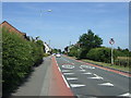
Walsall Road heading east
Towards Lichfield.
Image: © JThomas
Taken: 11 Jul 2013
0.09 miles
3

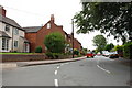
Rear window - snowy April
Leomansley Road - looking West
Image: © JonT
Taken: 6 Apr 2008
0.16 miles
4
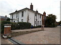
The Old Vicarage
Dating from the 1840s, with the later addition of a brick range to the rear, the Old Vicarage was originally built for Mrs Ellen Hinckley whose tomb lies behind the nearby church Image It was Grade II listed https://britishlistedbuildings.co.uk/101209846-easter-hill-and-the-old-vicarage-lichfield#.Yzm7FHbMLIU & https://historicengland.org.uk/listing/the-list/list-entry/1209846 in 1970. It's now divided into flats.
Image: © Richard Law
Taken: 20 Sep 2022
0.17 miles
7
Trunkfield Playground
Beside Trunkfield Brook and close to Darwin Park.
Image: © David Rogers
Taken: 28 Jun 2009
0.20 miles
8

Western edge of Sloppy Wood
Giant Hornbeam trees at the edge of Sloppy Wood, Leomansley
Image: © John Sawbridge
Taken: 23 Apr 2020
0.24 miles