The Old Vicarage
Introduction
The photograph on this page of The Old Vicarage by Richard Law as part of the Geograph project.
The Geograph project started in 2005 with the aim of publishing, organising and preserving representative images for every square kilometre of Great Britain, Ireland and the Isle of Man.

There are currently over 7.5m images from over 14,400 individuals and you can help contribute to the project by visiting https://www.geograph.org.uk
The Old Vicarage
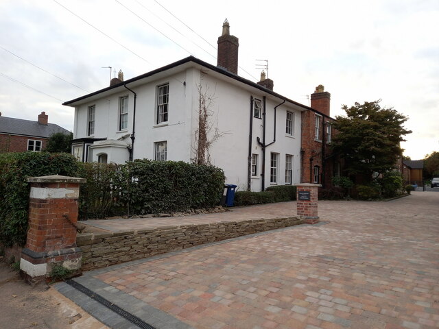
Image: © Richard Law Taken: 20 Sep 2022
Dating from the 1840s, with the later addition of a brick range to the rear, the Old Vicarage was originally built for Mrs Ellen Hinckley whose tomb lies behind the nearby church Image It was Grade II listed https://britishlistedbuildings.co.uk/101209846-easter-hill-and-the-old-vicarage-lichfield#.Yzm7FHbMLIU & https://historicengland.org.uk/listing/the-list/list-entry/1209846 in 1970. It's now divided into flats.
Images are licensed for reuse under creativecommons.org/licenses/by-sa/2.0
Image Location
Latitude
52.678977
Longitude
-1.845318