IMAGES TAKEN NEAR TO
Heathfield Lane West, WEDNESBURY, WS10 8QP
Introduction
This page details the photographs taken nearby to Heathfield Lane West, WS10 8QP by members of the Geograph project.
The Geograph project started in 2005 with the aim of publishing, organising and preserving representative images for every square kilometre of Great Britain, Ireland and the Isle of Man.

There are currently over 7.5m images from over14,400 individuals and you can help contribute to the project by visiting https://www.geograph.org.uk
Image Map
Images are licensed for reuse under creativecommons.org/licenses/by-sa/2.0
Notes
- Clicking on the map will re-center to the selected point.
- The higher the marker number, the further away the image location is from the centre of the postcode.
Image Listing (5 Images Found)
Images are licensed for reuse under creativecommons.org/licenses/by-sa/2.0
Image
Details
Distance
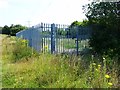
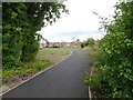
1
Heathfield Lane
The view from Wolverhampton Street in Darlaston.
Image: © Gordon Griffiths
Taken: 27 Sep 2016
0.19 miles
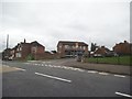
3
Herberts Park Houses
The view from the bridge on the Walsall Canal in Darlaston.
Image: © Gordon Griffiths
Taken: 15 Jul 2022
0.23 miles
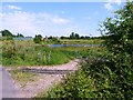
4
Catherine Cross Estate
The view from Heathfields Bridge on the Walsall Canal at Moxley, Darlaston.
Image: © Gordon Griffiths
Taken: 15 Jul 2022
0.24 miles