
IMAGES TAKEN NEAR TO
The Drive, WEDNESBURY, WS10 8AN
Introduction
This page details the photographs taken nearby to The Drive, WS10 8AN by members of the Geograph project.
The Geograph project started in 2005 with the aim of publishing, organising and preserving representative images for every square kilometre of Great Britain, Ireland and the Isle of Man.

There are currently over 7.5m images from over14,400 individuals and you can help contribute to the project by visiting https://www.geograph.org.uk
Image Map
Images are licensed for reuse under creativecommons.org/licenses/by-sa/2.0
Notes
- Clicking on the map will re-center to the selected point.
- The higher the marker number, the further away the image location is from the centre of the postcode.
Image Listing (8 Images Found)
Images are licensed for reuse under creativecommons.org/licenses/by-sa/2.0
Image
Details
Distance
1
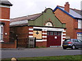
4th Darlaston Group
The Scout Hall on Victoria Road.
Image: © Gordon Griffiths
Taken: 13 Apr 2009
0.13 miles
2
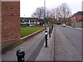
Station Street
A Darlaston Street.
Image: © Gordon Griffiths
Taken: 13 Apr 2009
0.17 miles
3
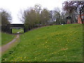
Darlaston Path
The path off Victoria Road.
Image: © Gordon Griffiths
Taken: 13 Apr 2009
0.17 miles
4
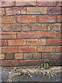
OS benchmark - Darlaston, factory on Bills Street
An OS cutmark on the outside wall of a works building on Bills Street; originally levelled at 128.19m above Ordnance Datum Newlyn.
Image: © Richard Law
Taken: 21 Jun 2016
0.21 miles
5
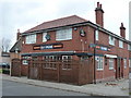
The Old Engine pub, Darlaston
A Banks's pub on Bull Street, which hides much of its frontage behind a rather unusual fence.
Image: © Richard Law
Taken: 12 Nov 2010
0.21 miles
6
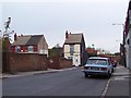
Bills Street, Fallings Heath, Darlaston
Image: © Adrian Bailey
Taken: 7 Nov 2005
0.22 miles
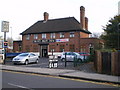
8

Salisbury Primary School, Station Street, Darlaston
A stone laid into the brickwork of the main front gable gives a date of 1910.
Image: © Richard Law
Taken: 12 Nov 2010
0.24 miles