IMAGES TAKEN NEAR TO
Darlaston Road, WEDNESBURY, WS10 7TZ
Introduction
This page details the photographs taken nearby to Darlaston Road, WS10 7TZ by members of the Geograph project.
The Geograph project started in 2005 with the aim of publishing, organising and preserving representative images for every square kilometre of Great Britain, Ireland and the Isle of Man.

There are currently over 7.5m images from over14,400 individuals and you can help contribute to the project by visiting https://www.geograph.org.uk
Image Map
Images are licensed for reuse under creativecommons.org/licenses/by-sa/2.0
Notes
- Clicking on the map will re-center to the selected point.
- The higher the marker number, the further away the image location is from the centre of the postcode.
Image Listing (18 Images Found)
Images are licensed for reuse under creativecommons.org/licenses/by-sa/2.0
Image
Details
Distance
1
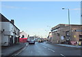
Walsall Road Darlaston Approaching Darlaston Road Junction
Image: © Roy Hughes
Taken: 17 Dec 2011
0.14 miles
2
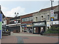
Darlaston - the dead centre
Closed stores outnumber those open at the southern end of King Street precinct. Photographed in mid-afternoon, shoppers are only notable by their absence.
Image: © Peter Whatley
Taken: 11 May 2010
0.16 miles
4
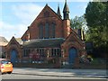
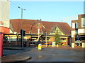
St Andrews
This Church of England Building is also used as Kings Hill Methodist Church.
Image: © Gordon Griffiths
Taken: 20 Oct 2007
0.17 miles
5
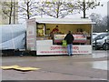
Coopers Stall
A mobile Family Butchers takes on the big boys, next to Asda car park in Darlaston.
Image: © Gordon Griffiths
Taken: 21 Nov 2009
0.18 miles
6
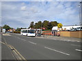
Bus station, St Lawrence Way, Darlaston
This small bus station, running to four stands (the fourth is just out of frame on the left), is more than adequate to handle all buses serving Darlaston, chiefly because almost no buses terminate here and therefore most buses spend only minimal time in the bus station.
Image: © Richard Vince
Taken: 22 Sep 2017
0.18 miles
7
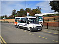
Community transport bus, Darlaston
Walsall Community Transport YX09 HRU, a Volkswagen Transporter based Mellor Tucana, lays over in the small bus station on St Lawrence Way, Darlaston. Although clearly designed for community transport type usage, with most seats removable, on this occasion it was working local bus service 30, which comprises five return trips four days per week between Bilston and Darlaston via some obscure bits of Moxley and Herberts Park. The vehicle is also fitted with a radio, so I was treated to 20 minutes of Jeremy Vine as I kept the driver company.
Image: © Richard Vince
Taken: 22 Sep 2017
0.19 miles
9
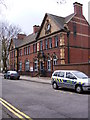
Darlaston Nick
The Police Station stands on Crescent Road by Victoria Park.
Image: © Gordon Griffiths
Taken: 13 Apr 2009
0.21 miles