IMAGES TAKEN NEAR TO
Darlaston Road, WEDNESBURY, WS10 7TA
Introduction
This page details the photographs taken nearby to Darlaston Road, WS10 7TA by members of the Geograph project.
The Geograph project started in 2005 with the aim of publishing, organising and preserving representative images for every square kilometre of Great Britain, Ireland and the Isle of Man.

There are currently over 7.5m images from over14,400 individuals and you can help contribute to the project by visiting https://www.geograph.org.uk
Image Map
Images are licensed for reuse under creativecommons.org/licenses/by-sa/2.0
Notes
- Clicking on the map will re-center to the selected point.
- The higher the marker number, the further away the image location is from the centre of the postcode.
Image Listing (9 Images Found)
Images are licensed for reuse under creativecommons.org/licenses/by-sa/2.0
Image
Details
Distance
1
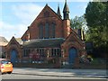
St Andrews
This Church of England Building is also used as Kings Hill Methodist Church.
Image: © Gordon Griffiths
Taken: 20 Oct 2007
0.05 miles
2
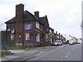
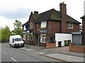
The Black Horse
A Darlaston Pub on Old Park Road.
Image: © Gordon Griffiths
Taken: 13 Apr 2009
0.19 miles
3
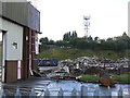
Derelict industrial building near Darlaston
Another one taken from the cab of my lorry while I was waiting to unload. This shows the last remnants of an industrial unit on the Woden Road industrial estate. It's now been replaced with two shiny new units. I don't know what this building was or when it was built, but looking at the brickwork it really doesn't look all that old.
Image: © John Winder
Taken: 26 Jul 2007
0.21 miles
6
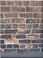
OS benchmark - Kings Hill, 29 Old Park Road
An infilled OS cutmark on the side wall of no 29 Old Park Road; originally levelled at 146.322m above Ordnance Datum Newlyn.
Image: © Richard Law
Taken: 22 Jun 2016
0.21 miles
7
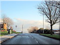
Woden Road West Approaching Darlaston Road Wednesbury
Image: © Roy Hughes
Taken: 17 Dec 2011
0.22 miles
8
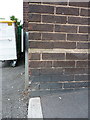
OS benchmark - Kings Hill, Black Horse public house
An OS cutmark on the front wall of Image; originally levelled at 142.915m above Ordnance Datum Newlyn.
Image: © Richard Law
Taken: 22 Jun 2016
0.24 miles