
IMAGES TAKEN NEAR TO
Moxley Road, WEDNESBURY, WS10 7RG
Introduction
This page details the photographs taken nearby to Moxley Road, WS10 7RG by members of the Geograph project.
The Geograph project started in 2005 with the aim of publishing, organising and preserving representative images for every square kilometre of Great Britain, Ireland and the Isle of Man.

There are currently over 7.5m images from over14,400 individuals and you can help contribute to the project by visiting https://www.geograph.org.uk
Image Map
Images are licensed for reuse under creativecommons.org/licenses/by-sa/2.0
Notes
- Clicking on the map will re-center to the selected point.
- The higher the marker number, the further away the image location is from the centre of the postcode.
Image Listing (25 Images Found)
Images are licensed for reuse under creativecommons.org/licenses/by-sa/2.0
Image
Details
Distance
1

The Red Lion
A pub on the Moxley Road, near Woods Bank
Image: © Richard Law
Taken: 2 Nov 2009
0.08 miles
2

Red Lion
A Pub on Moxley Road, Darlaston.
Image: © Gordon Griffiths
Taken: 21 Nov 2009
0.10 miles
3
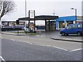
Moxley Road Garage
The Service Station on the A4038 near Darlaston.
Image: © Gordon Griffiths
Taken: 21 Nov 2009
0.14 miles

5

All Saints' Church, Moxley
Moxley Church, All Saints, was built and consecrated in 1851, for a new ecclesiastical parish, comprising the mining village and neighbourhood of Moxley, The church, inside the old Wednesbury boundary in Church Street, Moxley, is a stone building in the Early English style, including a tower and spire; the spire and the upper part of the tower were added in 1887.
Image: © David Dixon
Taken: 7 Apr 2023
0.17 miles
6

Derelict school at Moxley
Situated just behind All Saints Church, and is in a sad state now.
Image: © Richard Law
Taken: 10 Sep 2009
0.17 miles
7

All Saints Moxley
A Church on the Black Country New Road.
Image: © Gordon Griffiths
Taken: 20 Oct 2007
0.17 miles
8
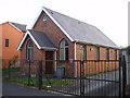
The National Spiritualist Church in Woods Bank
Built in 1926, this lies in the gloriously-named Pinfold Street Extension.
Image: © Richard Law
Taken: 2 Nov 2009
0.18 miles
9

A41, Moxley
Looking towards All Saints Church
Image: © Geoff Pick
Taken: 5 Dec 2009
0.19 miles
10
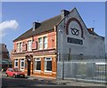
The 'Staffordshire Knot' near Darlaston
Until absorbed into the West Midlands County these small Black Country towns were within Staffordshire. The pub displays the county emblem and badge of the county regiment.
Image: © John M
Taken: 23 Sep 2006
0.19 miles