
IMAGES TAKEN NEAR TO
Bower Hill, DROITWICH, WR9 8TG
Introduction
This page details the photographs taken nearby to Bower Hill, WR9 8TG by members of the Geograph project.
The Geograph project started in 2005 with the aim of publishing, organising and preserving representative images for every square kilometre of Great Britain, Ireland and the Isle of Man.

There are currently over 7.5m images from over14,400 individuals and you can help contribute to the project by visiting https://www.geograph.org.uk
Image Map
Images are licensed for reuse under creativecommons.org/licenses/by-sa/2.0
Notes
- Clicking on the map will re-center to the selected point.
- The higher the marker number, the further away the image location is from the centre of the postcode.
Image Listing (35 Images Found)
Images are licensed for reuse under creativecommons.org/licenses/by-sa/2.0
Image
Details
Distance
1
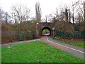
Cycle route dips under the railway
Cyclists keep on the right as we face it. A very useful route in Droitwich, Worcestershire joining the Chawson Estate to Ombersley Way. It is a much longer route by car.
Image: © Jeff Gogarty
Taken: 25 Oct 2015
0.06 miles
2
Safe bridge under railway, Droitwich
Image: © Jeff Gogarty
Taken: 1 Jan 2016
0.07 miles
3
Subway under railway for cyclists and walkers
Part of the national cycle network in Droitwich, Worcestershire
Image: © Jeff Gogarty
Taken: 26 Dec 2015
0.07 miles
4
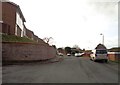
Looking back from the end of Severndale, Droitwich
Image: © Jeff Gogarty
Taken: 26 Dec 2015
0.11 miles
5
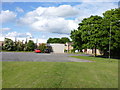
Emmanuel, Church on the Hill, Droitwich Spa
The church on Blake Avenue is temporarily closed. I believe a new church building is going to be built on this site.
Image: © Jeff Gogarty
Taken: 20 Jun 2015
0.12 miles
6
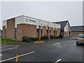
The new Emmanuel Church on Blake Avenue, Droitwich
Image: © Jeff Gogarty
Taken: 26 Dec 2021
0.12 miles
7
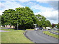
End of Route
The cycle route from Blake Avenue, Droitwich Spa links to National Route 46 by cycle path and through quiet estate roads to National Route 45.
Behind the trees is a disused church hall and a Spa Shop.
Image: © Jeff Gogarty
Taken: 20 Jun 2015
0.14 miles
9

Bus shelter in Ombersley Way, Droitwich
Beyond the bus shelter there are houses in a new estate, many in cul-de-sacs
Image: © David Smith
Taken: 20 May 2013
0.17 miles
10
Looking up Colforrd Walk from the railway crossing
Image: © Jeff Gogarty
Taken: 13 Mar 2016
0.19 miles