
IMAGES TAKEN NEAR TO
St. Andrews Drive, DROITWICH, WR9 8AL
Introduction
This page details the photographs taken nearby to St. Andrews Drive, WR9 8AL by members of the Geograph project.
The Geograph project started in 2005 with the aim of publishing, organising and preserving representative images for every square kilometre of Great Britain, Ireland and the Isle of Man.

There are currently over 7.5m images from over14,400 individuals and you can help contribute to the project by visiting https://www.geograph.org.uk
Image Map
Images are licensed for reuse under creativecommons.org/licenses/by-sa/2.0
Notes
- Clicking on the map will re-center to the selected point.
- The higher the marker number, the further away the image location is from the centre of the postcode.
Image Listing (77 Images Found)
Images are licensed for reuse under creativecommons.org/licenses/by-sa/2.0
Image
Details
Distance
1
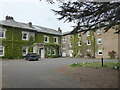
St Andrew's House Hotel, Droitwich
Early 19th century stuccoed house of Regency character. Now an hotel and Listed Grade II.
Image: © Chris Allen
Taken: 30 Apr 2022
0.01 miles
2
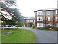
Droitwich Spa, St. Andrews House Hotel
Off Worcester Road; once the residence of the town clerk. The right-hand part of the hotel is listed by English Heritage: http://www.imagesofengland.org.uk/Details/Default.aspx?id=147363&mode=adv http://www.st-andrewshotel.com/
Image: © Mike Faherty
Taken: 3 Oct 2014
0.01 miles
3
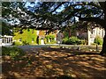
St Andrews House Hotel
Temporarily closed but re-opening soon.
Image: © Jeff Gogarty
Taken: 18 Sep 2021
0.02 miles
4
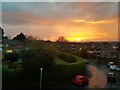
Sunset in Droitwich Spa
From Wedgberrow Close.
Image: © Jeff Gogarty
Taken: 12 Apr 2022
0.06 miles
5
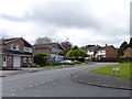
Spa Dental Surgery, Blackfriars Avenue
Junction of Fabricious Avenue, Blackfriars Avenue and Spa Road, Droitwich Spa, Worcestershire
Image: © Jeff Gogarty
Taken: 3 May 2015
0.07 miles
6
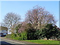
Trees on corner of Fabricius Avenue and Wedgberrow Close
These trees are in the garden of the Dentist Surgery on Blackfriars Avenue, Droitwich.
Image: © Jeff Gogarty
Taken: 13 Mar 2016
0.07 miles
7
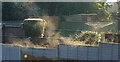
Steaming fences, warm sun and cold air
Wedgberrow Close, Droitwich Spa.
Image: © Jeff Gogarty
Taken: 31 Dec 2020
0.09 miles
8
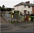
Manning Road electricity substation, Droitwich
The Western Power Distribution electricity substation is inside a locked compound
on the south side of Manning Road. Its identifier is MANNING ROAD 33397 (77/5837).
Image: © Jaggery
Taken: 16 Nov 2016
0.09 miles
9
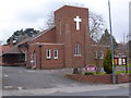
Droitwich Spa Methodist Church
Shown on the 1:50,000 sheet as a chapel although it has a very stubby square brick tower.
Image: © Chris Allen
Taken: 14 Feb 2015
0.09 miles
10
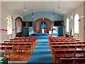
Interior of Droitwich Methodist Church
Image: © Jeff Gogarty
Taken: 3 Aug 2022
0.09 miles