
IMAGES TAKEN NEAR TO
Corbett Street, DROITWICH, WR9 7BQ
Introduction
This page details the photographs taken nearby to Corbett Street, WR9 7BQ by members of the Geograph project.
The Geograph project started in 2005 with the aim of publishing, organising and preserving representative images for every square kilometre of Great Britain, Ireland and the Isle of Man.

There are currently over 7.5m images from over14,400 individuals and you can help contribute to the project by visiting https://www.geograph.org.uk
Image Map
Images are licensed for reuse under creativecommons.org/licenses/by-sa/2.0
Notes
- Clicking on the map will re-center to the selected point.
- The higher the marker number, the further away the image location is from the centre of the postcode.
Image Listing (87 Images Found)
Images are licensed for reuse under creativecommons.org/licenses/by-sa/2.0
Image
Details
Distance
1
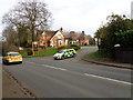
Police cars at the Castle pub, Droitwich
Image: © Jeff Gogarty
Taken: 2 Dec 2015
0.04 miles
2
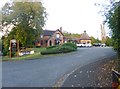
Droitwich Spa, The Castle
Pub on Worcester Road; the original building, to the left, is dated 1881; to the right is an extension. Internally, back bar, with eating & drinking areas left, front, right and back; pool, games machines, background music. Cask ales available at my visit: Attwood ABA, Sharp's Doom Bar.
Image: © Mike Faherty
Taken: 3 Oct 2014
0.05 miles
3
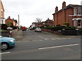
Junction of Corbett Street with Worcester Road, Droitwich
Image: © Jeff Gogarty
Taken: 2 Dec 2015
0.05 miles
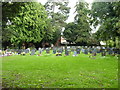
5
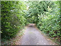
Lane to cemetery beside the Castle Pub
Droitwich, Worcestershire
Image: © Jeff Gogarty
Taken: 24 Sep 2016
0.06 miles
6
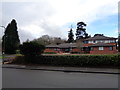
The Corbett Medical Practice, Corbett Avenue, Droitwich
With pharmacy attached.
Image: © Jeff Gogarty
Taken: 10 Jan 2016
0.07 miles
7
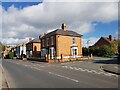
Junction of St Peters Road with Worcester Road, Droitwich
The house on the corner is a dental practice.
Image: © Jeff Gogarty
Taken: 7 Oct 2020
0.07 miles
8
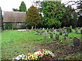
Hidden cemetery, Droitwich
Next to the former Highfields Hospital site and next to a public house. Not even shown on the Landranger map.
The small chapel was on the site of a mediaeval church and was demolished in 2012.
Image: © Chris Allen
Taken: 9 Dec 2007
0.08 miles
9
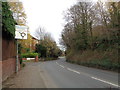
Worcester Road dropping down to the Saltway, Droitwich
Image: © Jeff Gogarty
Taken: 2 Dec 2015
0.09 miles
10
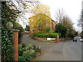
The Larches, Worcester Road, Droitwich
Where a large house, run as a guest house, and garden once stood there are now two blocks of flats.
Image: © Jeff Gogarty
Taken: 2 Dec 2015
0.09 miles