IMAGES TAKEN NEAR TO
Woodhall Court, DROITWICH, WR9 0DW
Introduction
This page details the photographs taken nearby to Woodhall Court, WR9 0DW by members of the Geograph project.
The Geograph project started in 2005 with the aim of publishing, organising and preserving representative images for every square kilometre of Great Britain, Ireland and the Isle of Man.

There are currently over 7.5m images from over14,400 individuals and you can help contribute to the project by visiting https://www.geograph.org.uk
Image Map
Images are licensed for reuse under creativecommons.org/licenses/by-sa/2.0
Notes
- Clicking on the map will re-center to the selected point.
- The higher the marker number, the further away the image location is from the centre of the postcode.
Image Listing (18 Images Found)
Images are licensed for reuse under creativecommons.org/licenses/by-sa/2.0
Image
Details
Distance
1
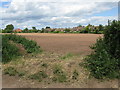
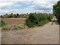
The last ploughed field
Isolated from other farmland by lanes and houses, a ploughed field off Chapel Lane, Ombersley.
Image: © Peter Whatley
Taken: 19 Jun 2008
0.10 miles
2
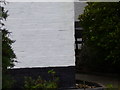
Nineteenth century benchmark on Pound Cottage
This bench mark was established in 1849 during the First primary levelling of England & Wales, and was levelled with a height of 131.0040 feet [39.9300 metres] above mean sea level (Liverpool datum). It was included on the Worcester to Aberystwyth levelling line. The surveyor's description was "No. 16. Mark on corner of Thomas Diggan's house, at junction of roads ; 3.31 ft. above surface" (Public Abstract p.550).
Image: © Shantavira
Taken: 5 Jan 2016
0.11 miles
3
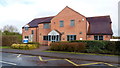
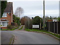
Ombersley Medical Centre
A fairly recent addition to the local community infrastructure.
Image: © Jonathan Billinger
Taken: 6 Mar 2019
0.12 miles
4
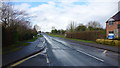
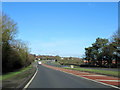
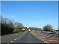
Main road north from Ombersley
The A4133 merges with the A449 bypass a short distance ahead.
Image: © Jonathan Billinger
Taken: 6 Mar 2019
0.12 miles
5
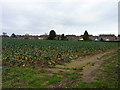
Field of sprouts
With back of houses of Sandys Road, Ombersley.
Image: © Jeff Gogarty
Taken: 6 Jan 2019
0.12 miles
6
Path to allotments from Sandys Road, Ombersley
It also goes to the Uphampton.
Image: © Jeff Gogarty
Taken: 6 Jan 2019
0.14 miles
8
Ombersley - Chapel Lane
The outer end of Chapel Lane transforms almost without boundaries into allotments and plouched fields.
Image: © Peter Whatley
Taken: 19 Jun 2008
0.15 miles
9
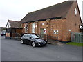
Ombersley Memorial Hall, Sandys Road, Ombersley
Image: © Jeff Gogarty
Taken: 6 Jan 2019
0.15 miles