IMAGES TAKEN NEAR TO
Chatley, DROITWICH, WR9 0AP
Introduction
This page details the photographs taken nearby to WR9 0AP by members of the Geograph project.
The Geograph project started in 2005 with the aim of publishing, organising and preserving representative images for every square kilometre of Great Britain, Ireland and the Isle of Man.

There are currently over 7.5m images from over14,400 individuals and you can help contribute to the project by visiting https://www.geograph.org.uk
Image Map
Images are licensed for reuse under creativecommons.org/licenses/by-sa/2.0
Notes
- Clicking on the map will re-center to the selected point.
- The higher the marker number, the further away the image location is from the centre of the postcode.
Image Listing (10 Images Found)
Images are licensed for reuse under creativecommons.org/licenses/by-sa/2.0
Image
Details
Distance
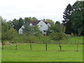
1
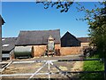
A working farm at Chatley, Worcestershire
Image: © Jeff Gogarty
Taken: 20 Apr 2023
0.07 miles
3
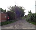
Lane and bridle path at Chatley
Goes to the River Salwarpe and the Droitwich Barge Canal.
Image: © Jeff Gogarty
Taken: 17 Sep 2016
0.08 miles
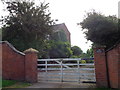
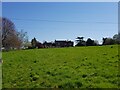
5
Mayfield Farm, Chatley, Worcestershire
Image: © Jeff Gogarty
Taken: 17 Sep 2016
0.15 miles
6
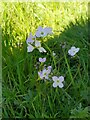
Lady's Smock, Cuckoo Flower, Cardamine pratensis
Image: © Jeff Gogarty
Taken: 20 Apr 2023
0.15 miles
7
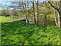
Pond near Bournehouse Farm, Chatley, Worcestershire
Image: © Jeff Gogarty
Taken: 20 Apr 2023
0.20 miles
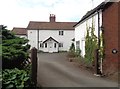
8
Passing Bournehouse Farm, Chatley, Worcestershire (2)
Image: © Jeff Gogarty
Taken: 20 Apr 2023
0.21 miles
9
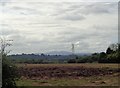
Muddy field, pylon and distant Malvern Hills
Image: © Jeff Gogarty
Taken: 17 Sep 2016
0.22 miles
10
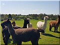
Alpacas at a farm near Chatley, Worcestershire
Image: © Jeff Gogarty
Taken: 20 Apr 2023
0.23 miles