IMAGES TAKEN NEAR TO
Upton Snodsbury, WORCESTER, WR7 4PD
Introduction
This page details the photographs taken nearby to WR7 4PD by members of the Geograph project.
The Geograph project started in 2005 with the aim of publishing, organising and preserving representative images for every square kilometre of Great Britain, Ireland and the Isle of Man.

There are currently over 7.5m images from over14,400 individuals and you can help contribute to the project by visiting https://www.geograph.org.uk
Image Map
Images are licensed for reuse under creativecommons.org/licenses/by-sa/2.0
Notes
- Clicking on the map will re-center to the selected point.
- The higher the marker number, the further away the image location is from the centre of the postcode.
Image Listing (11 Images Found)
Images are licensed for reuse under creativecommons.org/licenses/by-sa/2.0
Image
Details
Distance
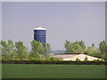
1
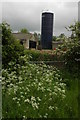
Farm silo at Moorend Barn
Farm silo at Moorend Barn to the east of Upton Snodsbury.
Image: © Philip Halling
Taken: 17 May 2008
0.05 miles
2
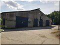
Moorend Barn, Upton Snodsbury
This building looks like it could have been used for poultry farming.
Image: © Jeff Gogarty
Taken: 14 Jul 2022
0.06 miles

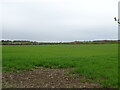
7
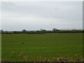
Upton Snodsbury Church from a distance (2)
Image: © Jeff Gogarty
Taken: 11 May 2023
0.19 miles
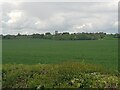
9
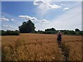
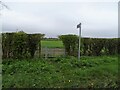
Walkers on the Millennium Way near Upton Snodsbury
Image: © Jeff Gogarty
Taken: 14 Jul 2022
0.23 miles