IMAGES TAKEN NEAR TO
Witley Road, WORCESTER, WR6 6PB
Introduction
This page details the photographs taken nearby to Witley Road, WR6 6PB by members of the Geograph project.
The Geograph project started in 2005 with the aim of publishing, organising and preserving representative images for every square kilometre of Great Britain, Ireland and the Isle of Man.

There are currently over 7.5m images from over14,400 individuals and you can help contribute to the project by visiting https://www.geograph.org.uk
Image Map
Images are licensed for reuse under creativecommons.org/licenses/by-sa/2.0
Notes
- Clicking on the map will re-center to the selected point.
- The higher the marker number, the further away the image location is from the centre of the postcode.
Image Listing (36 Images Found)
Images are licensed for reuse under creativecommons.org/licenses/by-sa/2.0
Image
Details
Distance
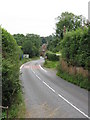
2
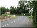
Martley - Stourport road junction
At the northern end of the village, the main north-south B4197 route is a "TOTSO" in road engineering parlance ("turn off to stay on [the same route]").
Image: © Peter Whatley
Taken: 31 Jul 2008
0.10 miles
3
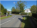
Road junction, Martley
A B road junction in a Worcestershire village. Round to the left is Shelsley Walsh and Tenbury while to the left is Stourport and Great Whitley.
Image: © Chris Allen
Taken: 26 Sep 2020
0.11 miles
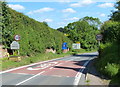
5
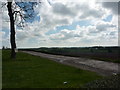
Martley - rock cutting
The B4204 approaches Martley through a sheer sandstone rock cutting on a steep, curving alignment. A footway has been created on top of the cutting to save additional excavation.
Image: © Peter Whatley
Taken: 31 Jul 2008
0.12 miles
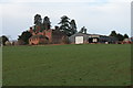
7
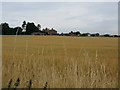
The village of Martley
There are modern buildings in the foreground, while the impressive brick structure in the distance is Noak Farmhouse, built in the early 17th century with additions dating from 1853.
Image: © Fabian Musto
Taken: 5 Jul 2021
0.16 miles
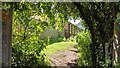
8
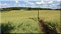
Path by the Chantry School (Martley)
There are two public footpaths at the north-west corner of the Chantry School, and this one goes to the B4197 road. I didn't take this path since this goes off track from the six ½ mile Martley circular walk.
Image: © Fabian Musto
Taken: 5 Jul 2021
0.16 miles
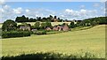
10
The Chantry School (Martley)
Here is the secondary school at Martley, and that is the Chantry School, founded in the early 19th century and moved to its present location in 1963. The school now has academy status since 2012, and the path in the foreground is the six ½ mile Martley circular walk.
Image: © Fabian Musto
Taken: 5 Jul 2021
0.16 miles