
IMAGES TAKEN NEAR TO
Ravenshill Close, WORCESTER, WR5 3SQ
Introduction
This page details the photographs taken nearby to Ravenshill Close, WR5 3SQ by members of the Geograph project.
The Geograph project started in 2005 with the aim of publishing, organising and preserving representative images for every square kilometre of Great Britain, Ireland and the Isle of Man.

There are currently over 7.5m images from over14,400 individuals and you can help contribute to the project by visiting https://www.geograph.org.uk
Image Map
Images are licensed for reuse under creativecommons.org/licenses/by-sa/2.0
Notes
- Clicking on the map will re-center to the selected point.
- The higher the marker number, the further away the image location is from the centre of the postcode.
Image Listing (152 Images Found)
Images are licensed for reuse under creativecommons.org/licenses/by-sa/2.0
Image
Details
Distance
1
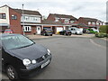
The blind end of Queenswood Drive, St Peter The Great
This is a cul-de-sac both in a vehicle and on foot. I just had to turn round and retrace my steps. Many of the streets around here are linked together by paths that can be walked, but not this particular one.
Image: © Chris Allen
Taken: 21 Mar 2021
0.03 miles
2
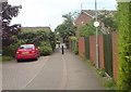
Saltwells pedway
The St Peters estate is well supplied with paths that shorten your way on foot or cycle . This one cuts through to Tesco.
Image: © Andrew Darge
Taken: 3 Jun 2009
0.04 miles
3
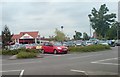
Tesco on St Peters Worcester
The corner shop for the estate .
Image: © Andrew Darge
Taken: 3 Jun 2009
0.07 miles
4
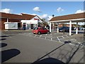
Tesco, St Peter's
The St Peter's Tesco supermarket in Worcester.
Image: © Philip Halling
Taken: 5 Apr 2016
0.07 miles
5
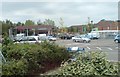
Tesco garage
The filling station beside Tesco St Peters superstore.
Image: © Andrew Darge
Taken: 3 Jun 2009
0.07 miles
6
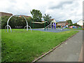
Play area off Batsford Road, St Peter the Great, Worcester
Image: © Chris Allen
Taken: 9 Aug 2021
0.08 miles
7
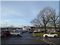
Tesco winter 2018
The oak trees in the car park have survived and the various small trees planted in the car park are growing well.
Image: © Andrew Darge
Taken: 22 Dec 2018
0.08 miles
8
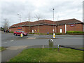
Tesco supermarket, St Peter The Great, Worcester
A supermarket in a large housing development that abuts the worcester Bypass road.
Image: © Chris Allen
Taken: 21 Mar 2021
0.09 miles
9
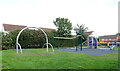
Children's playground, St Peter The Great, Worcester
Image: © JThomas
Taken: 13 Aug 2021
0.09 miles
10
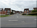
Alton Road across St Peter's Drive, Worcester
In the large St Peter The Great housing development. St Peter's Drive is the spine road that loops through the development from end to end and provides access to all the secondary branches and cul-de-sacs that constitute this development. It is analogous to Warndon Villages towards the other end of the Worcester bypass.
Image: © Chris Allen
Taken: 21 Mar 2021
0.09 miles