
IMAGES TAKEN NEAR TO
Barland Fields, WR5 2SY
Introduction
This page details the photographs taken nearby to Barland Fields, WR5 2SY by members of the Geograph project.
The Geograph project started in 2005 with the aim of publishing, organising and preserving representative images for every square kilometre of Great Britain, Ireland and the Isle of Man.

There are currently over 7.5m images from over14,400 individuals and you can help contribute to the project by visiting https://www.geograph.org.uk
Image Map
Images are licensed for reuse under creativecommons.org/licenses/by-sa/2.0
Notes
- Clicking on the map will re-center to the selected point.
- The higher the marker number, the further away the image location is from the centre of the postcode.
Image Listing (83 Images Found)
Images are licensed for reuse under creativecommons.org/licenses/by-sa/2.0
Image
Details
Distance
1
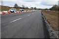
Widening Worcester's southern bypass
Work is now well underway on widening Worcester's southern bypass, upgrading it and making it a dual carriageway.
Image: © Philip Halling
Taken: 21 Feb 2015
0.08 miles
2
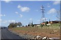
Pylon and new road
An opportunity to record this view before the carriageway is marked and in use
Image: © Andrew Darge
Taken: 10 Mar 2015
0.08 miles
3
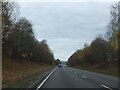
A4440 south of St Peter the Great estate
The trees that were planted when the road was created have begun to mature and provide autumn colour.
Image: © David Smith
Taken: 5 Nov 2011
0.08 miles
4
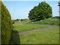
Start of the linear park beside the Ketch roundabout
A walkway and cycle route between the St Peters estate and the southern link road . Whittington Tump on the centre horizon.
Image
Image: © Andrew Darge
Taken: 24 May 2008
0.09 miles
5
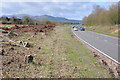
Worcester's southern relief road
Worcester's southern relief road passing St Peter's. This relief road was built in the 1980s and is about to be upgraded to a dual carriageway; the hedge on the left has been removed in preparation. The north end of the Malvern Hills can be seen in the background, including the Worcestershire Beacon and North Hill.
Image: © Philip Halling
Taken: 22 Mar 2014
0.09 miles
6
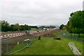
Dualing road works
The earth bund between Power Park and the dualled A4440 has been considerably raised and levelled and will take some time to reach the maturity it had before.
Image: © Andrew Darge
Taken: 14 Oct 2014
0.09 miles
7
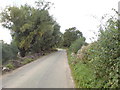
Taylors Lane
Looking west down this lane that soon could be incorporated into new housing as Worcester grows towards 2026
Image: © Andrew Darge
Taken: 29 Sep 2008
0.10 miles
8
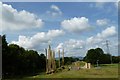
New play area in Power Park
A very pleasing play area with a civil war theme and constructed of natural materials is proving very popular with the children of the St. Peters estate.
Image: © Andrew Darge
Taken: 11 Jul 2011
0.10 miles
9
Civil war play area in Power Park
This imaginative play area has been popular with all ages and free from the attention of vandals .
Image: © Andrew Darge
Taken: 19 Sep 2012
0.11 miles
10
Taylors Lane
Depressing to know that almost all of this square and its neighbour to the east will eventually be developed to allow Worcester to meet its housing targets before 2026.
Image: © Andrew Darge
Taken: 29 Sep 2008
0.11 miles