IMAGES TAKEN NEAR TO
Kilbury Drive, WORCESTER, WR5 2NG
Introduction
This page details the photographs taken nearby to Kilbury Drive, WR5 2NG by members of the Geograph project.
The Geograph project started in 2005 with the aim of publishing, organising and preserving representative images for every square kilometre of Great Britain, Ireland and the Isle of Man.

There are currently over 7.5m images from over14,400 individuals and you can help contribute to the project by visiting https://www.geograph.org.uk
Image Map
Images are licensed for reuse under creativecommons.org/licenses/by-sa/2.0
Notes
- Clicking on the map will re-center to the selected point.
- The higher the marker number, the further away the image location is from the centre of the postcode.
Image Listing (72 Images Found)
Images are licensed for reuse under creativecommons.org/licenses/by-sa/2.0
Image
Details
Distance
1
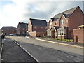
Cooke Close, Worcester
On a new estate.
Image: © Chris Allen
Taken: 28 Jan 2018
0.04 miles
2
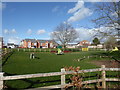
New play area, Worcester
Part of a housing development off Whittington Road. A fenced off WWII pillbox is just above the yellow gates right of centre.
Image: © Chris Allen
Taken: 2 Mar 2020
0.04 miles
3
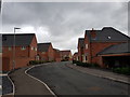
Houses on Cooke Close, Whittington, Worcester (2)
Image: © Jeff Gogarty
Taken: 9 Jul 2020
0.05 miles
4
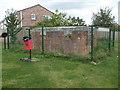
Preserved World War II pill box
This was to defend government offices on this site. The offices have gone and a new housing development is in full flow on their site. The pill box has been retained and fenced off as a reminder of the site's original purpose.
Image: © Chris Allen
Taken: 4 Sep 2019
0.06 miles
5
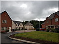
Houses on Cooke Close, Whittington, Worcester (1)
Whittington is a village but these belong more to the urban sprawl of Worcester.
Image: © Jeff Gogarty
Taken: 9 Jul 2020
0.07 miles
6
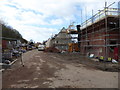
Hatton Grange building site
A no trespass view from the edge of the building works through an open access gate. Builders can be seen hard at it on a Sunday morning. This is a Persimmon homes development.
I am trying to establish if the other areas of new build that are contiguous are also Hatton Grange or whether they have different names and developers. I had assumed the whole complex was Hatton Grange.
Image: © Chris Allen
Taken: 22 Oct 2017
0.08 miles
7
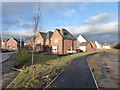
New estate, Worcester
Nearing completion but still a few finishing touches required. On the left is Cooke Close while the path to the right leads to a playground and some open space with adjoining allotments and the pond for the sustainable urban drainage system.
Image: © Chris Allen
Taken: 28 Jan 2018
0.08 miles
8
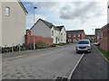
Vendeen Crescent, Weogoran Park, Worcester
Part of a new housing development that appears to be finished, including the road surface.
Image: © Chris Allen
Taken: 15 Mar 2021
0.08 miles
9
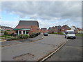
Persimmon Homes - Hatton Grange marketing suite
A new development on the edge of Worcester. The older Red Hill estate is seen to the left. The building is still continuing in one corner but the majority now seem to be occupied. This particular thoroughfare is Cooke Close. I seem to be the first to submit images to Geograph.
Image: © Chris Allen
Taken: 22 Oct 2017
0.09 miles