
IMAGES TAKEN NEAR TO
Blossom Close, WORCESTER, WR5 1SN
Introduction
This page details the photographs taken nearby to Blossom Close, WR5 1SN by members of the Geograph project.
The Geograph project started in 2005 with the aim of publishing, organising and preserving representative images for every square kilometre of Great Britain, Ireland and the Isle of Man.

There are currently over 7.5m images from over14,400 individuals and you can help contribute to the project by visiting https://www.geograph.org.uk
Image Map
Images are licensed for reuse under creativecommons.org/licenses/by-sa/2.0
Notes
- Clicking on the map will re-center to the selected point.
- The higher the marker number, the further away the image location is from the centre of the postcode.
Image Listing (907 Images Found)
Images are licensed for reuse under creativecommons.org/licenses/by-sa/2.0
Image
Details
Distance
1
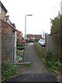
Blossom Close seen from the bridleway
Blossom Close is off Leopard Rise and is seen from the bridleway that has now been adapted to serve as the access road to the new Stableford development.
Image: © Chris Allen
Taken: 12 Nov 2020
0.02 miles
2
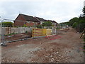
Closed bridleway, Worcester
This bridleway off Newtown Road is closed for about 6 months while works are under way to create an access road to the Stableford development by Elan Homes. This is seen through Heras fencing and is far as you can get to provide access to a house alongside the bridleway. The houses are on Aconbury Close and are not part of the new development.
Image: © Chris Allen
Taken: 25 Jul 2020
0.03 miles
3
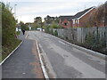
Newly widened access road, Worcester
This bridleway and access to the service reservoir has been widened and resurfaced as the access road to the Stableford housing development. It seems to alternate between one car wide and two cars wide. You can clearly see a change in the width of the road. The houses on the right are on Aconbury Close.
Image: © Chris Allen
Taken: 12 Nov 2020
0.03 miles
4
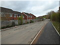
Access road for the Stableford housing development
This bridleway has been widened and resurfaced to provide access to new houses that are round the distant corner to the left. Straight on is access to the service reservoir. The houses on the left are on Aconbury Close.
Image: © Chris Allen
Taken: 12 Nov 2020
0.03 miles
5
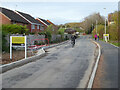
Access road to the Stableford development
This bridleway has been upgraded to act as the sole access to the new housing development known as Stableford. A foot path has been put down the right hand side and street lighting installed. It also provides access to the Severn Trent service reservoir that serves this elevated part of Worcester.
Image: © Chris Allen
Taken: 21 Nov 2020
0.03 miles
6
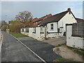
Bungalow by the access road to Stableford, Worcester
This road was formerly a bridleway and provided access to this property and a service reservoir. It has now been upgraded to support a new housing development. A footpath has been put down this side and lighting has been installed.
Image: © Chris Allen
Taken: 21 Nov 2020
0.03 miles
7
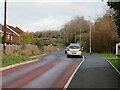
Oakmont Drive, Worcester
This is the sole access road to a new housing development. It is a widened pre-existing bridleway and reservoir access road. It seems to have been deliberately built for traffic calming with a section one car wide interspersed with wider sections for two way traffic. This latter is being negated by inconsiderate parking, almost certainly by employees of Worcestershire Royal Hospital. This is a perennial problem that can only be addressed by double yellow lines and enforcement.
Image: © Chris Allen
Taken: 11 Jan 2024
0.04 miles
8
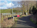
Bridleway and service reservoir
Off Newtown Road. There are signs of work starting on the new housing off to the left but a year later little has actually happened. To be honest, that bridleway doesn't look big enough for access.
Image: © Chris Allen
Taken: 11 Feb 2018
0.04 miles
9

New development off Newtown Road, Worcester
The late afternoon sun is bleaching the arm of the excavator and making it appear lighter than the body.
Image: © Chris Allen
Taken: 21 Jan 2020
0.04 miles
10

New housing development, Worcester
Seen from the bridleway off Newtown Road. This is the only access to the site and needs to be improved if it is not to act as a bottleneck to residents' traffic. The houses appear to be receiving gas and electricity despite the government's desire to remove gas from the energy scene.
Image: © Chris Allen
Taken: 1 Feb 2020
0.04 miles