
IMAGES TAKEN NEAR TO
Oaklands, WORCESTER, WR5 1SL
Introduction
This page details the photographs taken nearby to Oaklands, WR5 1SL by members of the Geograph project.
The Geograph project started in 2005 with the aim of publishing, organising and preserving representative images for every square kilometre of Great Britain, Ireland and the Isle of Man.

There are currently over 7.5m images from over14,400 individuals and you can help contribute to the project by visiting https://www.geograph.org.uk
Image Map
Images are licensed for reuse under creativecommons.org/licenses/by-sa/2.0
Notes
- Clicking on the map will re-center to the selected point.
- The higher the marker number, the further away the image location is from the centre of the postcode.
Image Listing (1056 Images Found)
Images are licensed for reuse under creativecommons.org/licenses/by-sa/2.0
Image
Details
Distance
1
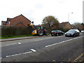
Newtown Road and hedge trimming, Worcester
Image: © Chris Allen
Taken: 17 Nov 2020
0.04 miles
2
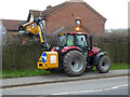
Hedge trimming, Newtown Road, Worcester
Image: © Chris Allen
Taken: 17 Nov 2020
0.04 miles
3
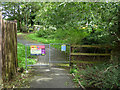
Entrance to Oaklands Play Area, Worcester
It is still possible to find new areas even when you have been exploring an area for 11 years.
Image: © Chris Allen
Taken: 5 Sep 2020
0.04 miles
4
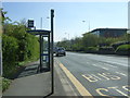
Bus stop and shelter on Newtown Road
Looking south east.
Image: © JThomas
Taken: 8 Apr 2017
0.04 miles
5
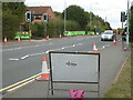
Infrastructure works on Newtown Road, Worcester
Several weeks of disruption seems to be down to telecommunications works along Newtown Road.
Image: © Chris Allen
Taken: 25 Sep 2021
0.05 miles
6
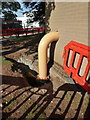
Worcestershire Royal Hospital - big yellow pipe
This view is from the public right of way on Newtown Road. This pipe had appeared in the last two or so days and is supplying gas from inside the brick building to a large bore pipe running in a trench towards the PFI hospital estates yard. It will supply gas to a combined heat and power plant that is to be relocated to that location.
Image: © Chris Allen
Taken: 12 Jun 2021
0.06 miles
7
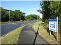
Newtown Road and a thank you sign
An empty Newtown Road at about 08:00 on a Sunday morning. On the right is a thank you sign to the NHS from the local parish. Nearby are a series of large roadside rainbows.
Image: © Chris Allen
Taken: 21 Jun 2020
0.06 miles
8
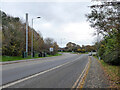
B4636 approaching the roundabout for the hospital
Newtown Road approaching the roundabout giving access to the Worcestershire Royal Hospital and Perry Manor Care Home. The hospital is to the right, Warndon Villages to the left and the Worcester Bypass and M5 are straight on.
Image: © Chris Allen
Taken: 17 Nov 2020
0.06 miles
9
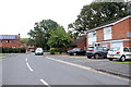
Leopard Rise
The road on this modern housing estate gets its name from the nearby Leopard Hill which is just to the north west.
Image: © Nigel Mykura
Taken: 28 Sep 2019
0.06 miles
10
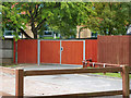
Worcestershire Royal Hospital - new gates
These nice new gates are seen from Newtown Road and close off the access to the mortuary. Better control of access was one of the issues flagged up in the last Human Tissue Authority report (freely available on line) and these gates were the answer to controlling access. There is now no through route past the mortuary and no easy access for unauthorised persons.
Image: © Chris Allen
Taken: 25 Jul 2020
0.06 miles