
IMAGES TAKEN NEAR TO
Wells Road, WORCESTER, WR5 1NN
Introduction
This page details the photographs taken nearby to Wells Road, WR5 1NN by members of the Geograph project.
The Geograph project started in 2005 with the aim of publishing, organising and preserving representative images for every square kilometre of Great Britain, Ireland and the Isle of Man.

There are currently over 7.5m images from over14,400 individuals and you can help contribute to the project by visiting https://www.geograph.org.uk
Image Map
Images are licensed for reuse under creativecommons.org/licenses/by-sa/2.0
Notes
- Clicking on the map will re-center to the selected point.
- The higher the marker number, the further away the image location is from the centre of the postcode.
Image Listing (278 Images Found)
Images are licensed for reuse under creativecommons.org/licenses/by-sa/2.0
Image
Details
Distance
1
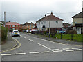
Carlisle Road, Ronkswood estate, Worcester
Seen from the junction with Canterbury Road. The roads in this large estate of social housing all appear to be named after cities.
Image: © Chris Allen
Taken: 11 Mar 2021
0.05 miles
2
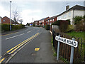
Durham Road, Ronkswood estate, Worcester
Seen from the junction with Canterbury Road. A large estate of social housing. The lighter coloured semis on the right are the original housing stock while the red brick ones are more recent rebuilds.
Image: © Chris Allen
Taken: 11 Mar 2021
0.06 miles
3
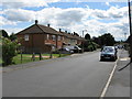
Ronkswood - Canterbury Road (east side)
Canterbury Road forms a loop around the Ronkswood estate. The core is grim. Photography is best done quickly.
Image: © Peter Whatley
Taken: 23 Jun 2008
0.06 miles
4
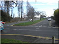
Newtown Road
View eastwards from the junction with Canterbury Road. The houses here enjoy a long lay-by which runs parallel with the main road.
Image: © Trevor Rickard
Taken: 11 Dec 2007
0.07 miles
5
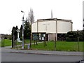
Holy Trinity & St Matthew's Church Ronkswood
An interesting modern design at the heart of the estate.
Image: © Chris Allen
Taken: 30 Mar 2009
0.07 miles
6
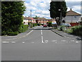
Ronkswood - Carlisle Road
Not part of Worcester's tourist trail.
Image: © Peter Whatley
Taken: 23 Jun 2008
0.07 miles
7
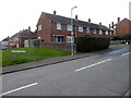
Lichfield Avenue from Canterbury Road, Ronkswood, Worcester
A large estate of social housing. Lichfield Avenue leads to the social centre with the pub, shops and the site of a now demolished church.
Image: © Chris Allen
Taken: 11 Mar 2021
0.08 miles
8
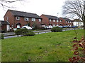
Rebuilt council houses, Ripon Road, Worcester
The white pair of semi-detached houses in the distance are the original design of house on the Ronkswood estate. These have been gradually replaced, one-by-one, by the design represented by the three pairs of red brick houses nearer the camera.
Image: © Chris Allen
Taken: 5 Mar 2016
0.08 miles
9
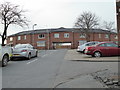
Site of former church, Worcester
This was where the 1960s church known at 'the drum' was sited before its demolition due to structural issues. It has been replaced by these flats but there are plans to build a worship space on some free land to the rear. Fundraising is in progress and I hope to bring you a picture of the finished project in due course. See - Image and Image
Image: © Chris Allen
Taken: 26 Mar 2017
0.08 miles
10
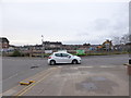
There it was gone! - Holy Trinity and St Matthew's Church
This 1960s design round church at the centre of the estate was demolished before Xmas 2014. It is seen before demolition here - Image
It was built in 1965 and closed in 2012 when part of the roof collapsed. Demolition started in November 2014 and it is to be replaced by a new multi-use building to serve the congregation and the community.
I used the post office just out of sight to the left on 31-12-14 and don't notice that something big was missing.
Image: © Chris Allen
Taken: 11 Jan 2015
0.08 miles