
IMAGES TAKEN NEAR TO
Chedworth Drive, WORCESTER, WR4 9PN
Introduction
This page details the photographs taken nearby to Chedworth Drive, WR4 9PN by members of the Geograph project.
The Geograph project started in 2005 with the aim of publishing, organising and preserving representative images for every square kilometre of Great Britain, Ireland and the Isle of Man.

There are currently over 7.5m images from over14,400 individuals and you can help contribute to the project by visiting https://www.geograph.org.uk
Image Map
Images are licensed for reuse under creativecommons.org/licenses/by-sa/2.0
Notes
- Clicking on the map will re-center to the selected point.
- The higher the marker number, the further away the image location is from the centre of the postcode.
Image Listing (61 Images Found)
Images are licensed for reuse under creativecommons.org/licenses/by-sa/2.0
Image
Details
Distance
1
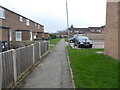
Houses off Chedworth Drive, Warndon
Part of a large housing estate. The path straight ahead leads to the school gates of a Roman Catholic School with an adjoining church. Despite the Covid-19 lockdown there were quite a few pupils and parents around so I did not take as many views as I would have done.
Image: © Chris Allen
Taken: 23 Feb 2021
0.01 miles
2
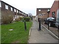
Path off Snowshill Close, Warndon
The building on the extreme right is a relatively recent replacement for some earlier buildings that look like garages on Google Maps.
Image: © Chris Allen
Taken: 23 Feb 2021
0.03 miles
3
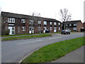
Snowshill Close from Chedworth Drive, Warndon, Worcester
Part of a large housing estate in Worcester.
Image: © Chris Allen
Taken: 23 Feb 2021
0.03 miles
4
Selsey Close from Chedworth Drive, Warndon, Worcester
Image: © Chris Allen
Taken: 23 Feb 2021
0.03 miles
5
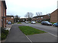
Snowshill Close, Warndon
The gate at the end separates Warndon from the more recent Warndon Villages - council housing from private housing. Apparently there is a 12 year difference in life expectancy in the areas separated by that gate.
Image: © Chris Allen
Taken: 23 Feb 2021
0.04 miles
6
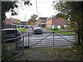
Snowshill Close, Worcester
Older housing seen from the path linking Snowshill Close to the Wall Meadow development in Warndon Villages. The closest red brick block on the right is a new build that is not seen on the aerial photograph or Streetview (as of November 2019).
Image: © Chris Allen
Taken: 4 Nov 2019
0.06 miles
7
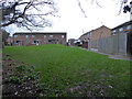
Grassy area behind Cirencester Place and Snowshill Close, Warndon
Snowshill Close is straight ahead and Cirencester Place is to the right. I had accessed this grassy area from a path behind Homestead Avenue in the neighbouring Warndon Villages complex of private houses.
Image: © Chris Allen
Taken: 23 Feb 2021
0.06 miles
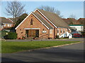
9
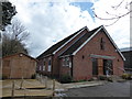
St Joseph RC Church, Warndon: early March 2016
Image: © Basher Eyre
Taken: 5 Mar 2016
0.07 miles
10
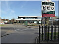
St Joseph's Catholic Primary School
From outside the gates. Weekends are the best time to photograph schools. The building on the extreme left is a Catholic church.
Image: © Chris Allen
Taken: 19 Feb 2023
0.07 miles