
IMAGES TAKEN NEAR TO
Warndon Green, WORCESTER, WR4 9HF
Introduction
This page details the photographs taken nearby to Warndon Green, WR4 9HF by members of the Geograph project.
The Geograph project started in 2005 with the aim of publishing, organising and preserving representative images for every square kilometre of Great Britain, Ireland and the Isle of Man.

There are currently over 7.5m images from over14,400 individuals and you can help contribute to the project by visiting https://www.geograph.org.uk
Image Map
Images are licensed for reuse under creativecommons.org/licenses/by-sa/2.0
Notes
- Clicking on the map will re-center to the selected point.
- The higher the marker number, the further away the image location is from the centre of the postcode.
Image Listing (85 Images Found)
Images are licensed for reuse under creativecommons.org/licenses/by-sa/2.0
Image
Details
Distance
1
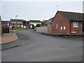
Brantwood from Warndon Green, Worcester
Image: © Chris Allen
Taken: 23 Feb 2021
0.03 miles
2
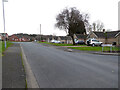
Warndon Green, Worcester
The sign on the right for Glenridding Close refers to a street that is out of sight to the right and perpendicular to the view direction. On this occasion the sign does not refer to the road I am photographing.
Image: © Chris Allen
Taken: 23 Feb 2021
0.04 miles
3
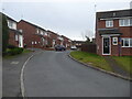
Brantwood, Warndon
I accessed this cul-de-sac from a path from Tolladine Road.
Image: © Chris Allen
Taken: 23 Feb 2021
0.05 miles
4
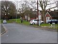
Hall Close from Warndon Green, Worcester
Image: © Chris Allen
Taken: 23 Feb 2021
0.05 miles
5
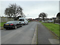
Warndon Green, Worcester
From the junction with Borrowdale Drive. Glenridding Close is on the right in the mid-distance.
Image: © Chris Allen
Taken: 23 Feb 2021
0.06 miles
6
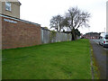
Warndon Green, Worcester
From the junction with Borrowdale Drive.
Image: © Chris Allen
Taken: 23 Feb 2021
0.07 miles
7
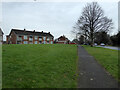
Housing on Tolladine Road, Worcester
Part of the large Warndon housing estate.
Image: © Chris Allen
Taken: 20 Feb 2021
0.09 miles
8
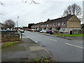
Borrowdale Drive, Warndon
The streets in this large council estate are named after places in the Lake District.
Image: © Chris Allen
Taken: 20 Feb 2021
0.10 miles
9
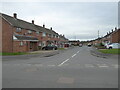
Bowness Drive from Borrowdale Drive, Warndon, Worcester
A large council housing estate with streets named after places in the Lake District.
Image: © Chris Allen
Taken: 23 Feb 2021
0.10 miles
10
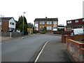
The end of Scafell Close, Worcester
I wandered up this cul-de-sac on the off-chance I could make my escape on foot. The no cycling sigh left of centre marks a path to Tolladine Road, so I was indeed able to continue without retracing my steps.
Image: © Chris Allen
Taken: 23 Feb 2021
0.10 miles