
IMAGES TAKEN NEAR TO
Berkeley Business Park, Wainwright Road, WORCESTER, WR4 9GY
Introduction
This page details the photographs taken nearby to Berkeley Business Park, Wainwright Road, WR4 9GY by members of the Geograph project.
The Geograph project started in 2005 with the aim of publishing, organising and preserving representative images for every square kilometre of Great Britain, Ireland and the Isle of Man.

There are currently over 7.5m images from over14,400 individuals and you can help contribute to the project by visiting https://www.geograph.org.uk
Image Map
Images are licensed for reuse under creativecommons.org/licenses/by-sa/2.0
Notes
- Clicking on the map will re-center to the selected point.
- The higher the marker number, the further away the image location is from the centre of the postcode.
Image Listing (91 Images Found)
Images are licensed for reuse under creativecommons.org/licenses/by-sa/2.0
Image
Details
Distance
1
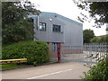
Distribution centre to let, Wainwright Road, Worcester
The aerial view shows that this is a moderate sized building in the context of this business park. The name of the former occupant has been removed from the posts outside the gate.
Image: © Chris Allen
Taken: 31 Jul 2020
0.06 miles
2
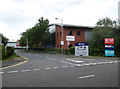
Berkeley Business Park, Worcester
A view up the entrance road that includes the traffic barrier but hides the security hut. I am not sure if the hut is actually manned. Although I don't mind telling security guards that photography from a public road is not illegal, I don't want to provoke them unnecessarily. The large building on the right is Ethos Energy's steam turbine repair centre. This is not a facility I would expect to see in Worcester but there it is.
Image: © Chris Allen
Taken: 31 Jul 2020
0.10 miles
3
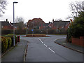
Looking down Stafford Avenue, Berkeley-Heywood
The roundabout is on Hastings Avenue that is one of the main roads dividing up 'villages' in the Berkeleys.
Image: © Chris Allen
Taken: 24 Nov 2019
0.11 miles
4
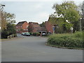
Looking into Stafford Avenue, Berkley-Heywood
Looking across the roundabout on Hastings Drive into Stafford Avenue in the area of Warndon Villages known as Berkley-Heywood. The villages are a large housing development that are largely on former fields with a few pre-existing structures and roads embedded within.
Image: © Chris Allen
Taken: 30 Oct 2019
0.11 miles
5
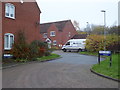
Newark Green, Berkley-Heywood
This area of Warndon Villages is known as the Berkeleys but the signs in this corner spell it as Berkley as in Berkley-Heywood. This is a short cul de sac off Stafford Avenue. It is only a short distance from the half-timbered St Nicholas church.
Image: © Chris Allen
Taken: 24 Nov 2019
0.11 miles
6
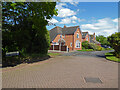
Deal Crescent, Berkeley-Pendesham, Worcester
Part of the Warndon Villages housing development near the edge of Worcester.
Image: © Chris Allen
Taken: 19 May 2021
0.11 miles
7
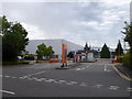
Sainsbury's Distribution Centre, Worcester
A large building hat is well screened by trees and best appreciated from the entrance. I wasn't aware this existed until I saw it on the aerial photograph. I am gradually photographing this part of Worcester and it is surprising how much industry there is tucked away.
Image: © Chris Allen
Taken: 31 Jul 2020
0.12 miles
8
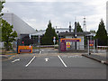
Sainsbury's Distribution Centre, Worcester
This is the entrance and one corner of the large Shire Park distribution centre. Seen from Wainwright Road. This large building has only recently come to my attention as I have not fully explored this corner of Worcester yet.
Image: © Chris Allen
Taken: 31 Jul 2020
0.12 miles
9
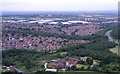
Worcester's huge sheds of warehousing by the motorway
Proximity to the Worcester north junction has meant an explosion of distribution centres and warehouses.
Image: © Andrew Darge
Taken: 17 Aug 2007
0.13 miles
10
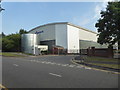
Worcester Bosch Distribution Centre
A rear view of this large distribution centre. Alongside the big cylindrical tank is a single storey building marked as the sprinkler pump house. Therefore the big tank presumably contains water for fire-fighting. There is a notice on the fence saying strictly no cameras on site. Fine, I was well on the public road. Alongside is a business park - Apex Park.
Image: © Chris Allen
Taken: 9 Aug 2020
0.13 miles