
IMAGES TAKEN NEAR TO
Furness Close, WORCESTER, WR4 9DX
Introduction
This page details the photographs taken nearby to Furness Close, WR4 9DX by members of the Geograph project.
The Geograph project started in 2005 with the aim of publishing, organising and preserving representative images for every square kilometre of Great Britain, Ireland and the Isle of Man.

There are currently over 7.5m images from over14,400 individuals and you can help contribute to the project by visiting https://www.geograph.org.uk
Image Map
Images are licensed for reuse under creativecommons.org/licenses/by-sa/2.0
Notes
- Clicking on the map will re-center to the selected point.
- The higher the marker number, the further away the image location is from the centre of the postcode.
Image Listing (84 Images Found)
Images are licensed for reuse under creativecommons.org/licenses/by-sa/2.0
Image
Details
Distance
1
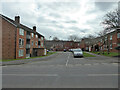
Furness Close from Langdale Drive
This is the edge of Warndon, a large estate of social housing with streets named after places in the Lake District.
Image: © Chris Allen
Taken: 6 Mar 2021
0.02 miles
2
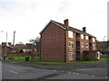
Flats in Furness Close
Viewed across Langdale Drive. The patterned brickwork breaks up the otherwise featureless gable end.
Note also the brick-built pillar box.
Image: © Richard Dorrell
Taken: 21 Nov 2015
0.04 miles
4
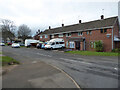
Rydal Close, Warndon, Worcester
Part of a large housing estate where the streets are named after places in the Lake District.
Image: © Chris Allen
Taken: 21 Nov 2020
0.05 miles
5
Glenthorne Avenue
Semi-detached housing in the Brickfields area of Worcester.
Image: © Richard Dorrell
Taken: 21 Nov 2015
0.05 miles
6
Langdale Drive, Warndon
One of the main routes through this large housing estate. On the left is the junction with Fairfield Close.
Image: © Chris Allen
Taken: 19 Jan 2023
0.05 miles
7
Mini-roundabout, Warndon, Worcester
This is at the T-junction between Langdale Drive straight ahead and Ambleside Drive to the right. This is in a large housing estate
Image: © Chris Allen
Taken: 6 Mar 2021
0.06 miles
8
Junction of Ambleside Drive and Langdale Drive, Worcester
The photographer is on Ambleside Drive and this makes a Tee-junction with a mini-roundabout with Langdale Drive. This is in a large housing estate with all the street names linked to places in the Lake District.
Image: © Chris Allen
Taken: 21 Nov 2020
0.06 miles
9
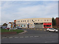
Shops and flats in Derwent Close
Viewed across Langdale Drive.
Image: © Richard Dorrell
Taken: 21 Nov 2015
0.06 miles
10
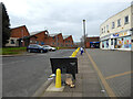
Derwent Close, Worcester
Although the map suggests this is Brickfields, the Lake district type name suggests it is more aligned with the adjoining Warndon estate. There are industrial buildings on the left and retail buildings on the right.
Image: © Chris Allen
Taken: 6 Mar 2021
0.07 miles