
IMAGES TAKEN NEAR TO
Ashby, WORCESTER, WR4 0SJ
Introduction
This page details the photographs taken nearby to Ashby, WR4 0SJ by members of the Geograph project.
The Geograph project started in 2005 with the aim of publishing, organising and preserving representative images for every square kilometre of Great Britain, Ireland and the Isle of Man.

There are currently over 7.5m images from over14,400 individuals and you can help contribute to the project by visiting https://www.geograph.org.uk
Image Map
Images are licensed for reuse under creativecommons.org/licenses/by-sa/2.0
Notes
- Clicking on the map will re-center to the selected point.
- The higher the marker number, the further away the image location is from the centre of the postcode.
Image Listing (90 Images Found)
Images are licensed for reuse under creativecommons.org/licenses/by-sa/2.0
Image
Details
Distance
1
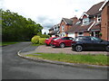
Ashby, Berkeley-Heywood
A cul-de-sac in Warndon Villages. This one has no exit on foot.
Image: © Chris Allen
Taken: 22 May 2021
0.01 miles
2
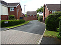
Ashby, Berkeley-Heywood
The entrance to this cul-de-sac seen from Brecon Avenue. Warndon Villages contains many cul-de-sacs; some have exits on foot but this one does not.
Image: © Chris Allen
Taken: 22 May 2021
0.01 miles
3
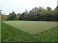
Astroturf patch in Warndon Villages
This is in the area known as the Berkeleys and is a patch of astroturf among the various developments. I am not sure what its original purpose was but it now look to be decidedly rough.
Image: © Chris Allen
Taken: 30 Oct 2019
0.06 miles
4
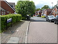
Ripley Gardens, Berkeley-Heywood, Worcester
Image: © Chris Allen
Taken: 22 May 2021
0.06 miles
5
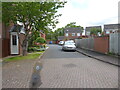
Skenfrith Place, Berkeley-Pendesham, Worcester
A cul-de-sac in Warndon Villages. I could not include the street name sign because a car was parked in front of it.
Image: © Chris Allen
Taken: 22 May 2021
0.07 miles
6
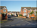
Goodrich Avenue, Berkeley-Pendesham
Seen from Hastings Drive. At the end of Goodrich Avenue it is crossed by Bamburgh Crescent. The streets in Berkeley-Pendesham all seemed to be named after locations with castles.
Image: © Chris Allen
Taken: 1 Dec 2019
0.07 miles
7
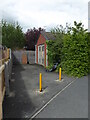
Substation on Brecon Avenue, Berkeley-Heywood
The substations in the large development that is Warndon Villages all appear to be within buildings rather than having the transformers in the open air. In fact, there are few exposed transformers that I can call to mind in Worcester.
Image: © Chris Allen
Taken: 22 May 2021
0.07 miles
8

Skenfrith place street sign, Berkeley-Pendesham
Thanks to this car obscuring the sign I was forced to take this from the 'wrong' direction. Rather than looking into Skenfrith place as I would prefer, I am stood in Skenfrith place and looking into Bamburgh Crescent. All the street names in the Berkeleys appear to be after places with castles.
Image: © Chris Allen
Taken: 22 May 2021
0.08 miles
9
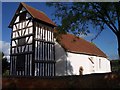
Warndon Church
Dedicated to St. Nicholas. originally a chapel to the manor house built around 1086. For more information see http://www.warndon-stnicholas-worcester.org.uk/
Image: © Bob Embleton
Taken: 9 Nov 2005
0.08 miles
10
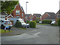
Brecon Avenue, Berkeley-Heywood, Worcester
Seen from Grosmont Avenue in part of the large modern Warndon Villages development.
Image: © Chris Allen
Taken: 19 May 2021
0.08 miles