
IMAGES TAKEN NEAR TO
Seven Acres, WORCESTER, WR4 0JD
Introduction
This page details the photographs taken nearby to Seven Acres, WR4 0JD by members of the Geograph project.
The Geograph project started in 2005 with the aim of publishing, organising and preserving representative images for every square kilometre of Great Britain, Ireland and the Isle of Man.

There are currently over 7.5m images from over14,400 individuals and you can help contribute to the project by visiting https://www.geograph.org.uk
Image Map
Images are licensed for reuse under creativecommons.org/licenses/by-sa/2.0
Notes
- Clicking on the map will re-center to the selected point.
- The higher the marker number, the further away the image location is from the centre of the postcode.
Image Listing (117 Images Found)
Images are licensed for reuse under creativecommons.org/licenses/by-sa/2.0
Image
Details
Distance
1

Road Junction in Home Meadow, Warndon Villages
I am stood on Snowberry Avenue that continues ahead to the right with Seven Acres forking off to the left. Home Meadow is one of four groupings with the Meadow suffix within Warndon Villages.
Image: © Chris Allen
Taken: 26 Nov 2019
0.02 miles
2
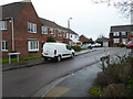
Bramhope Close from Grassington, Drive, Worcester
The older Warndon estate. Bramhope and Grassington are both places in Yorkshire.
Image: © Chris Allen
Taken: 20 Feb 2021
0.03 miles
3

Daty Croft, Home Meadow
Seen from Snowberry Avenue that is a sinuous cul-de-sac forming the main spine of Home Meadow.
Image: © Chris Allen
Taken: 26 Nov 2019
0.04 miles
4
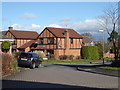
Snowberry Avenue and Hay Close, Home Meadow
This is one of the estates making up the Warndon Villages complex. You could spend quite some time covering all the roads and paths in Warndon Villages.
Image: © Chris Allen
Taken: 11 Feb 2018
0.04 miles
5
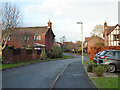
Snowberry Avenue, Home Meadow
Snowberry Avenue is the main sinuous cul-de-sac that gives rise to all the other streets in this area of Warndon Villages known as Home Meadow. Like many of the 'villages', Home Meadow only has one vehicular access point but many ways in and out by foot or bicycle.
Image: © Chris Allen
Taken: 26 Nov 2019
0.04 miles
6
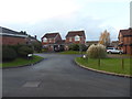
Hay Close, Home Meadow
Seen from Snowberry Avenue within Home Meadow that is part of Warndon Villages.
Image: © Chris Allen
Taken: 26 Nov 2019
0.05 miles
7
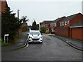
Burnsall Close from Grassington Drive, Warndon
The streets in this part of Warndon are all apparently named after places in Yorkshire while on the other side of the B4637 they are named after places in the Lake District.
Image: © Chris Allen
Taken: 20 Feb 2021
0.05 miles
8
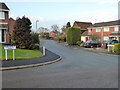
The junction of Threshfield Drive and Wharfedale Drive
In the Warndon area of Worcester.
Image: © Chris Allen
Taken: 26 Nov 2019
0.06 miles
9
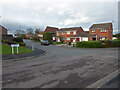
Three way junction, Warndon, Worcester
Three different street names are seen here. Threshfield Drive on the left joins Grassington Drive end on to the right and Wharfedale Drive is perpendicular in the centre.
Image: © Chris Allen
Taken: 21 Nov 2020
0.06 miles
10
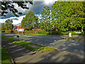
B4638 Woodgreen Drive, The Lyppards
This is the B-road that forms the spine of the large housing development known as Warndon Villages and here is in the area known as the Lyppards (as all the little estates are prefixed with Lyppard-)
Image: © Chris Allen
Taken: 6 Oct 2019
0.06 miles