
IMAGES TAKEN NEAR TO
Barley Crescent, WORCESTER, WR4 0HW
Introduction
This page details the photographs taken nearby to Barley Crescent, WR4 0HW by members of the Geograph project.
The Geograph project started in 2005 with the aim of publishing, organising and preserving representative images for every square kilometre of Great Britain, Ireland and the Isle of Man.

There are currently over 7.5m images from over14,400 individuals and you can help contribute to the project by visiting https://www.geograph.org.uk
Image Map
Images are licensed for reuse under creativecommons.org/licenses/by-sa/2.0
Notes
- Clicking on the map will re-center to the selected point.
- The higher the marker number, the further away the image location is from the centre of the postcode.
Image Listing (94 Images Found)
Images are licensed for reuse under creativecommons.org/licenses/by-sa/2.0
Image
Details
Distance
1
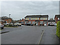
The blind end of Barley Crescent, Long Meadow, Worcester
Part of Warndon Villages - one of four 'Meadows' to the west of the B4638. Warndon Villages was erected on green fields at the edge of Worcester
Image: © Chris Allen
Taken: 20 Feb 2021
0.02 miles
2
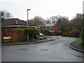
Norman Close from Barley Crescent, Long Meadow
One of many cul-de-sacs in the modern development known as Warndon Villages. Long Meadow is one of four 'Meadows' located to the west of the B4638 that bisects Warndon Villages.
Image: © Chris Allen
Taken: 20 Feb 2021
0.03 miles
3
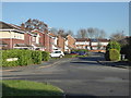
Barley Crescent, Long Meadow
Seen from Marsh Avenue.
One of four 'Meadows' in Warndon Villages (Home, Long, Great and Wall). The street name sign on the right in the distance marks Norman Close.
Image: © Chris Allen
Taken: 1 Dec 2019
0.04 miles

5
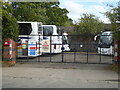
Commandery Coaches, Tolladine Road, Worcester
Image: © Chris Allen
Taken: 9 Oct 2022
0.04 miles
6
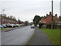
Tolladine Road, Warndon, Worcester
On the left are council houses and on the right a row of older terrace houses.
Image: © Chris Allen
Taken: 20 Feb 2021
0.05 miles
7
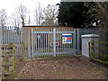
Gas installation, Tolladine road, Worcester
A natural gas installation that is probably a local pressure reducing station. This is between the older Warndon estate of social housing and the new Warndon Villages development.
Image: © Chris Allen
Taken: 6 Mar 2021
0.05 miles
9
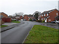
Marsh Avenue, Long Meadow, Warndon Villages, Worcester
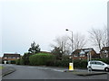
I am stood on a traffic island in the middle of Marsh Avenue. Marsh Avenue is the main spine road in Long Meadow and the only vehicular access to all the cul-de-sacs that lead off it. There are multiple points of egress on foot but not all the cul-de-sacs have pedestrian exits. I keep finding new routes in Warndon Villages.
Image: © Chris Allen
Taken: 20 Feb 2021
0.06 miles
10
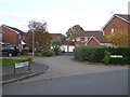
Upper Ground, Long Meadow
Seen from Marsh Avenue. The name does not appear on the aerial view but Streetview confirmed it. I have realised that when photographing Warndon Villages it is really useful to include street names in the view.
Image: © Chris Allen
Taken: 4 Nov 2019
0.06 miles